
Source: Bureau of Meteorology
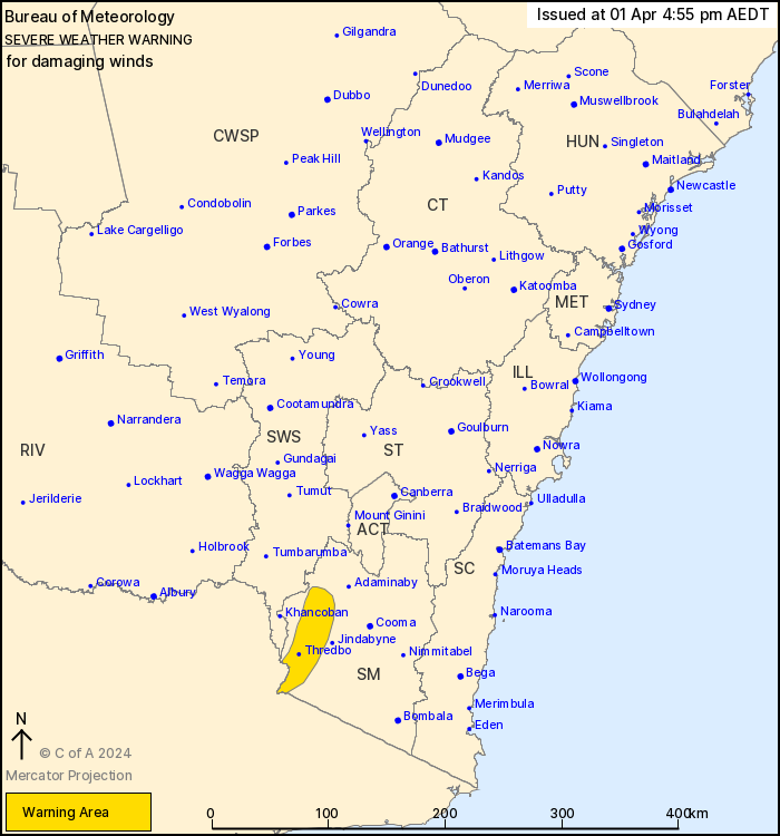
For people in parts of Snowy Mountains Forecast District.
Issued at 4:55 pm Monday, 1 April 2024.
Damaging winds to develop over alpine areas during Tuesday.
Weather Situation: A vigorous cold front will cross New South
Wales during Tuesday. Northwesterly winds will strengthen ahead of
the system during the day.
DAMAGING WINDS averaging 80 to 90 km/h with peak gusts up to 130
km/h are likely over alpine areas above 1900 m during Tuesday
morning, easing into the afternoon.
Locations which may be affected include Perisher Valley, Charlotte
Pass and Thredbo Top Station.
The State Emergency Service advises that people should:
* Move vehicles under cover or away from trees.
* Secure or put away loose items around your house, yard and
balcony.
* Keep at least 8 metres away from fallen power lines or objects
that may be energised, such as fences.
* Trees that have been damaged by fire are likely to be more
unstable and more likely to fall.
* Report fallen power lines to either Ausgrid (131 388), Endeavour
Energy (131 003), Essential Energy (132 080) or Evoenergy (131 093)
as shown on your power bill.
* Stay vigilant and monitor conditions. Note that the landscape
may have changed following bushfires.
* For emergency help in floods and storms, ring your local SES
Unit on 132 500.
01/Apr/2024 06:38 AM


