
Source: Bureau of Meteorology
Issued at 11:47 am EST on Friday 29 March 2024
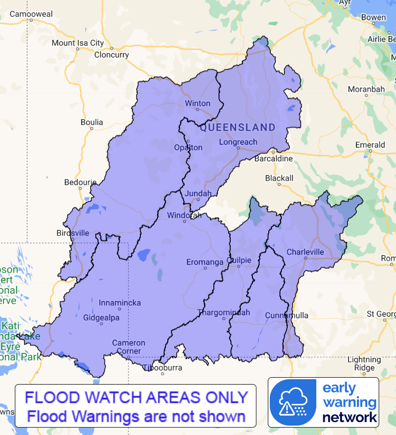
Flood Watch Number: 9
RENEWED FLOODING POSSIBLE ACROSS SOUTH WEST QUEENSLAND
A slow moving trough near the Queensland and Northern Territory
border will bring tropical moisture southwards. The trough is
expected to remain in the southwest of Queensland for most of the
weekend.
Catchments within the Flood Watch area are relatively dry but
wetting up in areas of rainfall over the last few days.
Showers tending to rain, and the chance of thunderstorms with
locally heavy falls, are forecast across the Flood Watch area over
the next few days.
Renewed river level rises and minor riverine flooding are possible
within the Flood Watch area, with isolated moderate flooding
possible, which may cause disruption to transport and isolation of
communities.
Catchments likely to be affected include:
Warrego River (QLD)
Paroo River (QLD)
Bulloo River (QLD)
Thomson River
Cooper Creek
Diamantina River
Flood Warnings remain current for: Diamantina River, Georgina
River and Eyre Creek.
See www.bom.gov.au/qld/warnings to view the current flood warnings
for Queensland.
For more information on the Flood Watch Service:
http://www.bom.gov.au/water/floods/floodWarningServices.shtml
Flood Safety Advice:
This Flood Watch means that people living or working along rivers
and creeks should monitor the latest weather forecasts and
warnings.
Remember: If it's flooded, forget it.
For flood emergency assistance contact the SES on 132 500.
For life threatening emergencies, call Triple Zero (000)
immediately.
Current emergency information is available at
www.qld.gov.au/alerts.
This advice is also available by dialling 1300 659 219 at a low
call cost of 27.5 cents, more from mobile, public and satellite
phones.
Warning, rainfall and river information are available at
www.bom.gov.au/qld/flood/
Rainfall and River
Conditions Map
29/Mar/2024 02:05 AM


