
Source: Bureau of Meteorology
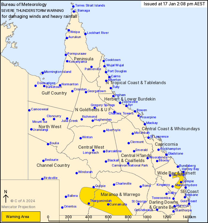
For people in parts of Channel Country, Wide Bay and Burnett,
Maranoa and Warrego and Southeast Coast Forecast Districts.
Issued at 2:08 pm Wednesday, 17 January 2024.
Severe thunderstorms about the SE Queensland north of Brisbane and
about the southern interior.
Weather Situation: A trough low pressure and a humid airmass over
the southern inland and low level convergence about the SE
Queensland coast is generating severe thunderstorms.
Severe thunderstorms are likely to produce damaging winds and
heavy rainfall that may lead to flash flooding over the next
several hours in parts of the Channel Country and Maranoa and
Warrego districts. Locations which may be affected include
Thargomindah, Cunnamulla, Eromanga, Eulo, Wyandra and Hebel.
Severe thunderstorms are likely to produce heavy rainfall that may
lead to flash flooding over the next several hours in parts of the
Wide Bay and Burnett and Southeast Coast districts. Locations which
may be affected include Gympie, Maryborough, Hervey Bay, Biggenden,
Imbil and Tiaro.
Mt Kanign recorded 86.6 mm in the 2 hours to 1.52 pm.
Emergency services advise people to:
* Park your car undercover away from trees.
* Close doors and windows.
* Keep asthma medications close by. Storms and wind can trigger
asthma attacks.
* Charge mobile phones and power banks in case the power goes
out.
* Put your pets somewhere safe and make sure they can be
identified in case they get lost.
* Do not drive now unless you have to because conditions are
dangerous.
* Tell friends, family and neighbours in the area.
* Go inside a strong building now. Stay inside until the storm has
passed.
17/Jan/2024 04:14 AM


