
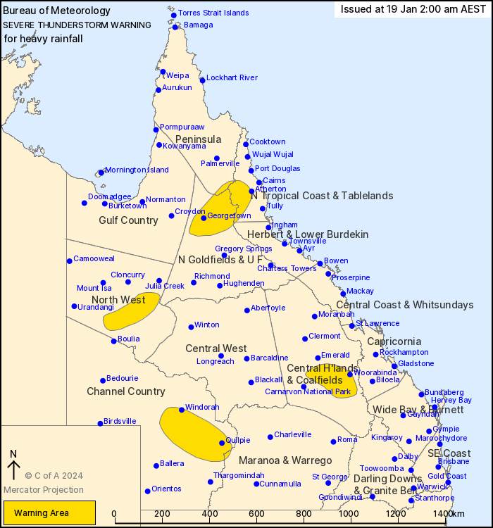
Source: Bureau of Meteorology
For people in parts of Peninsula, North Tropical Coast and
Tablelands, Northern Goldfields and Upper Flinders, North West,
Central Highlands and Coalfields, Channel Country, Herbert and
Lower Burdekin and Maranoa and Warrego Forecast Districts.
Issued at 2:00 am Friday, 19 January 2024.
Severe thunderstorms ongoing but becoming more isolated.
Weather situation: Severe thunderstorms are ongoing this morning
in parts of central and western Queensland, as well as along the
monsoon trough in the north.
Severe thunderstorms are likely to produce heavy rainfall that may
lead to flash flooding in the warning area over the next several
hours. Locations which may be affected include Georgetown, Quilpie,
Windorah, Rolleston, Springsure and Mount Garnet.
200 mm in 3 hours to 9:06 pm Thursday at Black Mt (northwest of
Cairns)
123 mm in 3 hours to 10:50 pm Thursday at Mount Surprise (east of
Georgetown)
60 mm in 1 hour to 11:50 pm Thursday at Downfall Creek Alert (east
of Taroom)
Emergency services advise people to:
* Park your car undercover away from trees.
* Close doors and windows.
* Keep asthma medications close by. Storms and wind can trigger
asthma attacks.
* Charge mobile phones and power banks in case the power goes
out.
* Put your pets somewhere safe and make sure they can be
identified in case they get lost.
* Do not drive now unless you have to because conditions are
dangerous.
* Tell friends, family and neighbours in the area.
* Go inside a strong building now. Stay inside until the storm has
passed.
18/Jan/2024 04:08 PM


