
Source: Bureau of Meteorology
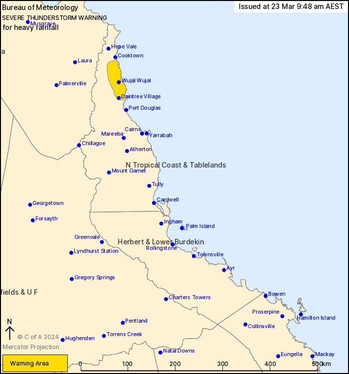
For people in parts of North Tropical Coast and Tablelands
Forecast District.
Issued at 9:48 am Saturday, 23 March 2024.
Severe thunderstorms with heavy rainfall about the North Tropical
Coast north of Cairns
Weather Situation: A weak trough near the North Tropical Coast is
combining with a very moist and moderately unstable airmass to
produce persistent heavy showers and a few thunderstorms in a
slow-moving band about the coast and nearby ranges north of
Cairns.
Severe thunderstorms are likely to produce heavy rainfall that may
lead to flash flooding in the warning area over the next several
hours. Locations which may be affected include Wujal Wujal and
Daintree Village.
Emergency services advise people to:
* Park your car undercover away from trees.
* Close doors and windows.
* Keep asthma medications close by. Storms and wind can trigger
asthma attacks.
* Charge mobile phones and power banks in case the power goes
out.
* Put your pets somewhere safe and make sure they can be
identified in case they get lost.
* Do not drive now unless you have to because conditions are
dangerous.
* Tell friends, family and neighbours in the area.
* Go inside a strong building now. Stay inside until the storm has
passed.
22/Mar/2024 11:58 PM


