
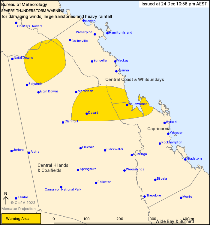
Source: Bureau of Meteorology
For people in parts of Central Coast and Whitsundays, Central
Highlands and Coalfields, Capricornia, Northern Goldfields and
Upper Flinders and Herbert and Lower Burdekin Forecast
Districts.
Issued at 10:56 pm Sunday, 24 December 2023.
Severe thunderstorms are persisting.
Weather Situation: A strong upper trough moving over southern
parts of the state is promoting severe thunderstorms across a broad
area of southeastern and eastern Queensland.
Severe thunderstorms are likely to produce damaging winds, large
hailstones and heavy rainfall that may lead to flash flooding in
the warning area over the next several hours. Locations which may
be affected include St Lawrence and Dysart.
Severe thunderstorms are no longer occurring in the Central West
district and the warning for this district is CANCELLED.
30mm was recorded at Gambubal in 30min to 10:30am.
35mm was recorded at Sandy Creek Road in 30min to 10:45am.
9cm hail recorded at Burpengary.
8cm hail recorded at Dayboro around 11:50am.
58mm of rainfall in 30 minutes at Wivenhoe Dam.
Emergency services advise people to:
* Park your car undercover away from trees.
* Close doors and windows.
* Keep asthma medications close by. Storms and wind can trigger
asthma attacks.
* Charge mobile phones and power banks in case the power goes
out.
* Put your pets somewhere safe and make sure they can be
identified in case they get lost.
* Do not drive now unless you have to because conditions are
dangerous.
* Tell friends, family and neighbours in the area.
* Go inside a strong building now. Stay inside until the storm has
passed.
24/Dec/2023 01:01 PM


