
Source: Bureau of Meteorology
Issued at 11:38 am WST on Thursday 22 February 2024
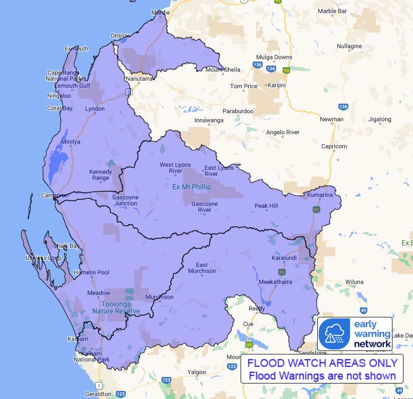
Flood Watch Number: 2
FLOODING POSSIBLE IN PARTS OF PILBARA AND GASCOYNE COAST RIVERS
FROM LATE FRIDAY
Ex-Tropical Cyclone Lincoln located off the Kimberley coast
northwest of the Dampier Peninsula, will move west to southwest
during today where it will likely redevelop into a Tropical Cyclone
during tonight, while offshore from the Pilbara coast. It is
expected to take a more south to southwest track on Saturday
towards the far west Pilbara coast, possibly passing close to
Exmouth during the day. The potential cyclone will weaken on Sunday
to a Tropical Low as it moves over the western Gascoyne.
Catchments in the Flood Watch area are relatively dry.
Widespread rainfall totals of 70-100 mm with isolated totals above
180 mm are forecast for Saturday over the Pilbara and Gascoyne
Coast River catchments.Further rainfall totals of 50-70 mm with
isolated up to 120 mm possible over parts of the Flood Watch area
on Sunday.
Significant river, creek, and stream rises are likely with heavy
rainfall, with flooding possible across parts of the Flood Watch
area from late Friday.
Many roads, and possibly primary and secondary highways may be
affected. Some communities and homesteads may become isolated.
Check road conditions before travelling.
Catchments likely to be affected include:
Onslow Coast
Lyndon-Minilya Rivers
Gascoyne River
Wooramel River
Murchison River
This flood watch is available by dialling 1300 659 213. For more
information on the Flood Watch Service visit
http://www.bom.gov.au/water/floods/floodWarningServices.shtml
Flood Safety Advice:
DFES advises people and communities to be aware that flooding is
possible and be prepared to relocate equipment and livestock. Watch
water levels. Travellers need to be aware that road conditions may
be adversely affected and travel plans may need to be reconsidered.
Do not drive into water of unknown depth and velocity.
Community information is available from DFES at
www.dfes.wa.gov.au
Current river levels are available from Department of Water and
Environmental Regulation at www.water.wa.gov.au
Rainfall and River
Conditions Map
22/Feb/2024 03:50 AM


