
Source: Bureau of Meteorology
Issued at 11:51 am WST on Thursday 25 January 2024
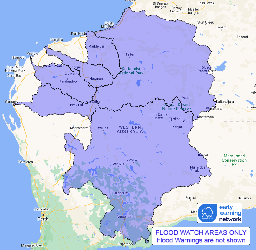
Flood Watch Number: 10
FLOODING POSSIBLE IN PARTS OF THE SANDY DESERT, DE GREY RIVER ,
FORTESCUE RIVER, ASHBURTON RIVER, GASCOYNE RIVER AND SALT LAKES
DISTRICT
A deep tropical low over the northeast Gascoyne is slowly moving
east southeast towards the far northern Goldfields today, bringing
heavy rainfall over the Flood Watch area.
The tropical low will move into the interior on Friday and is
expected to dissipate into a trough.
Catchments in the Flood Watch area are wetting up from recent
rainfall, which is resulting in rises in streams and creeks. Heavy
rainfall has been observed over the southern/central Pilbara region
with Three Rivers (Meekatharra) receiving 102 mm in the 24 hours to
9am.
Heavy rainfall and thunderstorms are forecast across the Flood
Watch area. Widespread daily rainfall totals of 30-80 mm are
forecast with isolated falls of 100-150 mm possible for the next
two days.
Significant river, creek, and stream rises are likely with heavy
rainfall, with possible flooding across the Flood Watch area during
the next week.
Flooding may affect road conditions which is likely to impact
travel and movement across the Flood Watch area for the next few
days.
Some communities and homesteads may get isolated. Check road
conditions before travelling.
Catchments likely to be affected include:
De Grey River
Fortescue River
Ashburton River
Gascoyne River
Salt Lakes District Rivers
Sandy Desert
A minor flood warning for the Fitzroy River catchment is
current.
This flood watch is available by dialling 1300 659 213. For more
information on the Flood Watch Service visit
http://www.bom.gov.au/water/floods/floodWarningServices.shtml
Flood Safety Advice:
DFES advises people and communities to be aware that flooding is
possible and be prepared to relocate equipment and livestock. Watch
water levels. Travellers need to be aware that road conditions may
be adversely affected and travel plans may need to be reconsidered.
Do not drive into water of unknown depth and velocity.
Community information is available from DFES at
www.emergency.wa.gov.au/
Current river levels are available from Department of Water and
Environmental Regulation at
www.water.wa.gov.au/maps-and-data/monitoring/river-level-monitoring
Rainfall and River
Conditions Map
25/Jan/2024 04:20 AM


