
Source: Bureau of Meteorology
Issued at 11:49 am WST on Saturday 23 March 2024
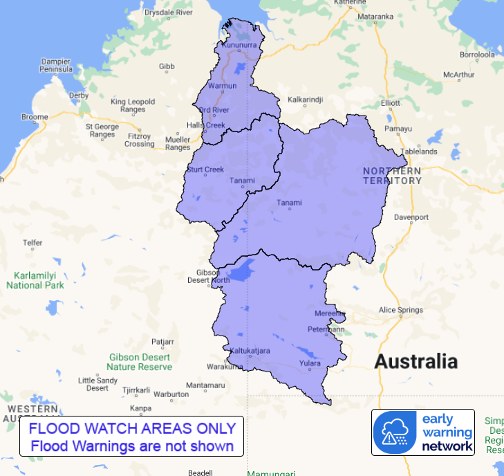
Flood Watch Number: 4
ISOLATED FLOODING POSSIBLE IN THE FLOOD WATCH AREA OVER THE
WEEKEND
The remnants of Ex-Tropical Cyclone Megan have moved into the
Kimberley region and are forecast to move south resulting in areas
of increased rain and thunderstorm activity.
Catchments in the Flood Watch area are relatively wet following
flooding over recent weeks.
Rain and storms with isolated heavy falls are forecast over the
next few days. Widespread daily totals of 30-70 mm, with isolated
totals of 100 mm are possible during the next few days across the
Flood Watch area.
River, creek and stream rises are possible with heavy rainfall and
localised flooding causing inundation across parts of the Flood
Watch area.
Roads, and possibly secondary highways may be affected. Some
communities and homesteads may become isolated. Check road
conditions before travelling.
Catchments likely to be affected include:
East Kimberley Rivers
Sturt Creek District
Tanami Desert
Western Desert
This flood watch is available by dialling 1300 659 213. For more
information on the Flood Watch Service visit
http://www.bom.gov.au/water/floods/floodWarningServices.shtml
Flood Safety Advice:
DFES advises people and communities to be aware that flooding is
possible and be prepared to relocate equipment and livestock. Watch
water levels. Travellers need to be aware that road conditions may
be adversely affected and travel plans may need to be reconsidered.
Do not drive into water of unknown depth and velocity.
Community information is available from DFES at
www.emergency.wa.gov.au/
Current river levels are available from Department of Water and
Environmental Regulation at
www.water.wa.gov.au/maps-and-data/monitoring/river-level-monitoring
Rainfall and River
Conditions Map
23/Mar/2024 04:04 AM


