
Source: Bureau of Meteorology
Fire Weather Warning
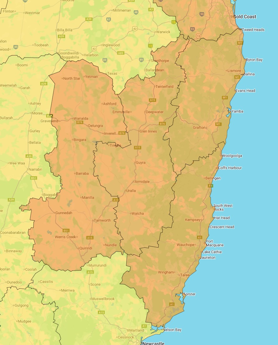
for the Far North Coast, North Coast, New England and Northern
Slopes fire weather districts
Issued at 4:02 pm EDT on Sunday 26 October 2025.
The NSW Rural Fire Service advises you to:
Action your Bushfire Survival Plan now.
Monitor the fire and weather situation through your local radio
station, www.rfs.nsw.gov.au and www.bom.gov.au.
Call 000 (Triple Zero) in an emergency.
For Monday 27 October:
Extreme Fire Danger is forecast for the following fire weather
districts:
Far North Coast, North Coast, New England and Northern
Slopes
Weather Situation
Warm to hot and dry conditions, combined with fresh to locally
strong and gusty westerly winds will result in extreme fire danger
over the Far North Coast, North Coast, New England and Northern
Slopes fire weather districts on Monday. The chance of a
thunderstorm over the far northeast. A cooler, gusty south to
southeast wind change is expected in the afternoon and
evening.
for the Upper Central West Plains fire weather district
Issued at 4:36 am EDT on Sunday 26 October 2025.
The NSW Rural Fire Service advises you to:
Action your Bushfire Survival Plan now.
Monitor the fire and weather situation through your local radio
station, www.rfs.nsw.gov.au and www.bom.gov.au.
Call 000 (Triple Zero) in an emergency.
For the rest of Sunday 26 October:
Extreme Fire Danger is forecast for the following fire weather
district:
Upper Central West Plains
Weather Situation
Hot and dry conditions in combination with strong and gusty winds
will result in extreme fire danger over the Upper Central West
Plains fire weather district tomorrow. Northerly winds will shift
west to northwesterly during the early afternoon. High based
showers and thunderstorms are possible with little to no
rainfall.
For information on preparing for bushfires go to
www.rfs.nsw.gov.au.
Fire
Danger Ratings and Total Fire Bans
26/Oct/2025 08:55 AM


