
Source: Bureau of Meteorology
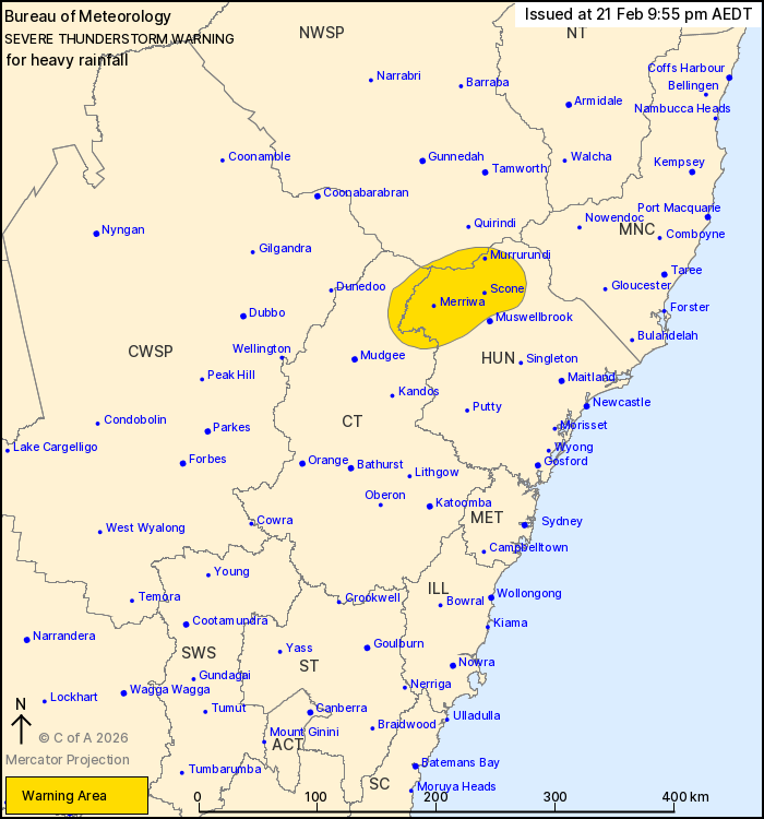
For people in parts of Hunter, Central Tablelands and North West
Slopes and Plains Forecast Districts.
Issued at 9:55 pm Saturday, 21 February 2026.
Heavy rainfall with storms in the Upper Hunter
Weather Situation: Slow moving thunderstorms over the Upper Hunter
this evening in a moist unstable atmosphere may become locally
severe at times.
Severe thunderstorms are likely to produce heavy rainfall that may
lead to flash flooding in the warning area over the next several
hours. Locations which may be affected include Scone, Merriwa and
Murrurundi.
Severe thunderstorms are no longer occurring in the Mid North
Coast and Northern Tablelands districts and the warning for these
districts is CANCELLED.
81.6 MM WAS RECORDED AT KINGDON PONDS (YARRANDI BRIDGE) IN THE 2
HOURS TO 7:49 PM
80 MM WAS RECORDED AT SCONE IN THE 2 HOURS TO 8 PM.
52 mm was recorded at Comboyne (Thorne River) in the 60 min to
5:15 pm.
96 km/h wind gust was recorded at Scone at 6:21 pm.
The State Emergency Service advises that people should:
* Keep clear of creeks and storm drains.
* Don't walk, ride your bike or drive through flood water.
* If you are trapped by flash flooding, seek refuge in the highest
available place and ring 000 if you need rescue.
* Stay indoors away from windows, and keep children and pets
indoors as well.
For emergency help in flood and storms, ring the SES on 132
500.
Stay updated on the Hazards Near Me NSW app or the ACT ESA website
(https://esa.act.gov.au).
21/Feb/2026 11:00 AM

