
Source: Bureau of Meteorology
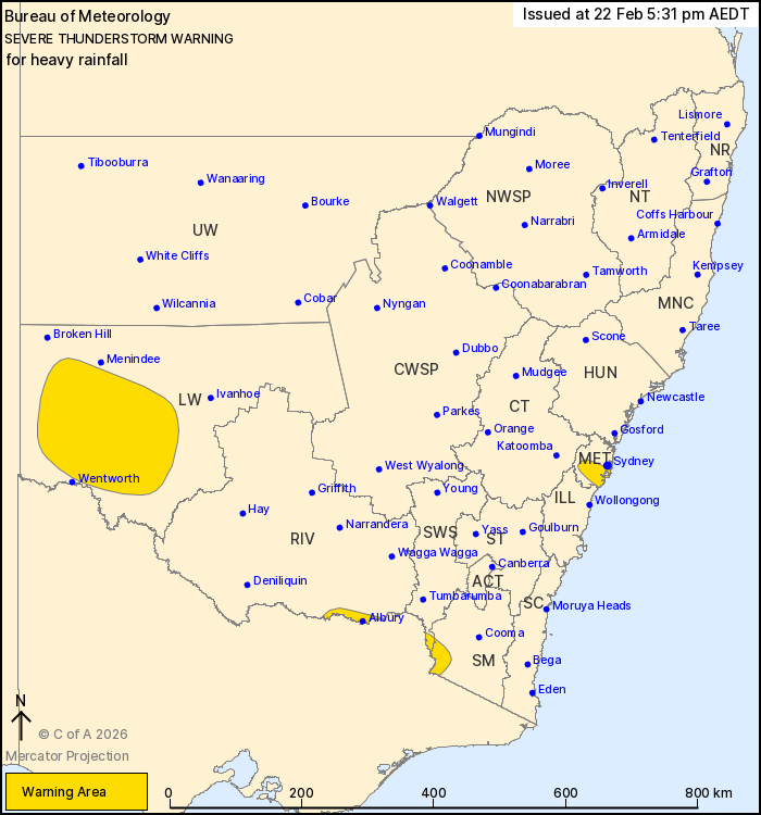
For people in parts of Metropolitan, Lower Western, Snowy
Mountains, South West Slopes and Riverina Forecast Districts.
Issued at 5:31 pm Sunday, 22 February 2026.
Heavy rainfall about the southwest and Sydney basin this
afternoon.
Weather Situation: A trough and cold front combines with a moist
and unstable airmass in southwestern parts of the state to produce
severe showers and thunderstorms this afternoon. A seabreeze
convergence is triggering severe thunderstorms with heavy rainfall
about the Sydney basin.
Severe thunderstorms are likely to produce heavy rainfall that may
lead to flash flooding in the warning area over the next several
hours. Locations which may be affected include Albury, Charlotte
Pass, Thredbo and Corowa.
The State Emergency Service advises that people should:
* Keep clear of creeks and storm drains.
* Don't walk, ride your bike or drive through flood water.
* If you are trapped by flash flooding, seek refuge in the highest
available place and ring 000 if you need rescue.
* Stay indoors away from windows, and keep children and pets
indoors as well.
For emergency help in flood and storms, ring the SES on 132
500.
Stay updated on the Hazards Near Me NSW app or the ACT ESA website
(https://esa.act.gov.au).
22/Feb/2026 06:44 AM

