
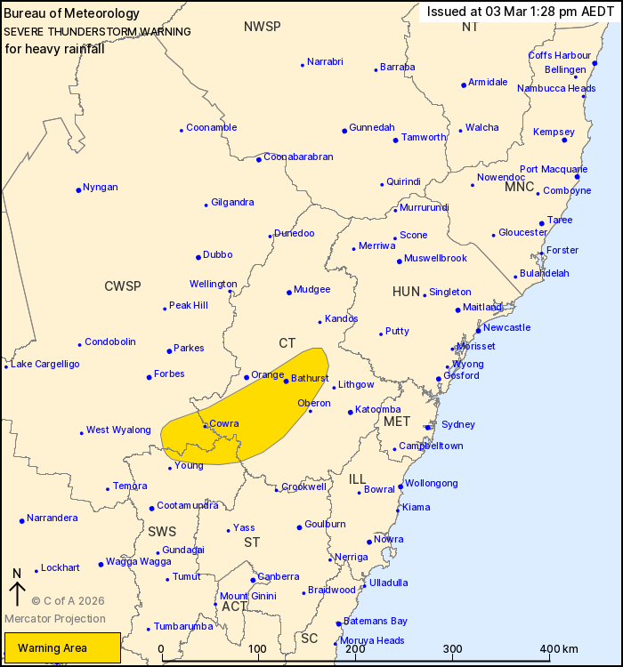
Source: Bureau of Meteorology
For people in parts of Central Tablelands, South West Slopes and
Central West Slopes and Plains Forecast Districts.
Issued at 1:28 pm Tuesday, 3 March 2026.
Severe thunderstorms with locally heavy rainfall likely over parts
of the central west of NSW
Weather Situation: A deep trough extends through the central west
of NSW, embedded within a very humid tropical airmass. Slow-moving
lines of heavy showers and thunderstorms developing in this area
will be capable of producing locally heavy rainfall.
Severe thunderstorms are likely to produce heavy rainfall that may
lead to flash flooding in the warning area over the next several
hours. Locations which may be affected include Bathurst, Cowra,
Capertee, Blayney and Trunkey Creek.
The State Emergency Service advises that people should:
* Keep clear of creeks and storm drains.
* Don't walk, ride your bike or drive through flood water.
* If you are trapped by flash flooding, seek refuge in the highest
available place and ring 000 if you need rescue.
* Stay indoors away from windows, and keep children and pets
indoors as well.
For emergency help in flood and storms, ring the SES on 132
500.
Stay updated on the Hazards Near Me NSW app or the ACT ESA website
(https://esa.act.gov.au).
03/Mar/2026 02:30 AM

