
Source: Bureau of Meteorology
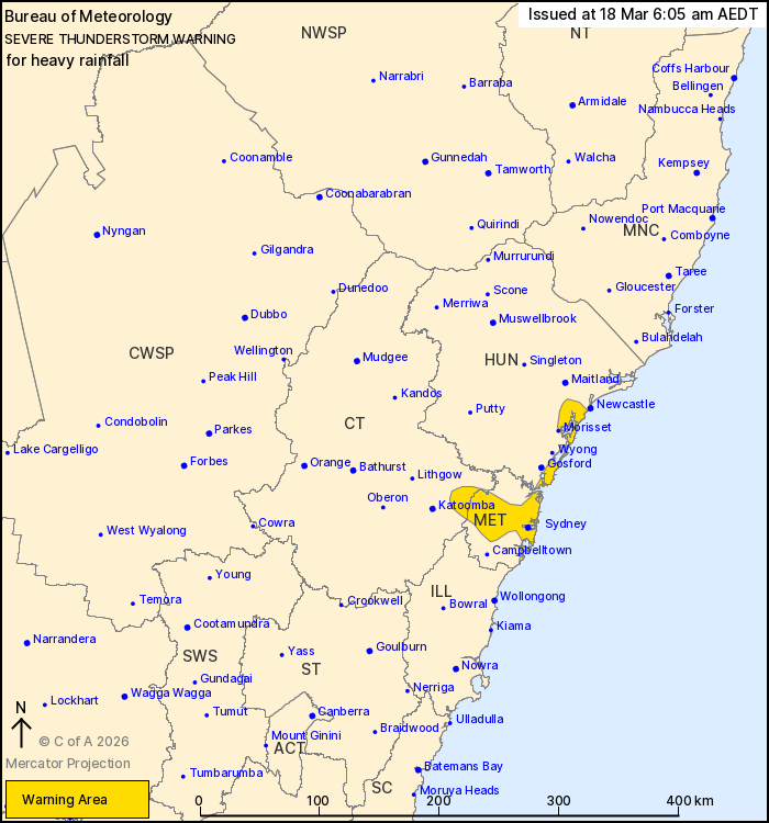
For people in parts of Metropolitan, Hunter and Central Tablelands
Forecast Districts.
Issued at 6:05 am Wednesday, 18 March 2026.
Slow moving thunderstorms have been producing heavy rain along the
central NSW coast.
Weather Situation: A southerly change has been moving up the coast
and combining with a mid level trough to trigger heavy rainfall in
a moist, unstable atmosphere.
Severe thunderstorms are likely to produce heavy rainfall that may
lead to flash flooding in the warning area over the next several
hours. Locations which may be affected include Sydney, Penrith,
Parramatta, Wallsend, Toronto and The Entrance.
93 MM WAS RECORDED AT MOSMAN IN 60 MIN TO 3:03 am
64 mm was recorded at Pearl Beach Reservoir in 60 min to 2:27
am
51 mm was recorded at Rose Bay in 30 min to 5:31 am
51 mm was recorded at Allambie in 30 min to 3:04 am
44 mm was recorded at Little Bay in 30 min to 5:07 am
42 mm was recorded at Wahroonga in 30 min to 3:13 am
The State Emergency Service advises that people should:
* Keep clear of creeks and storm drains.
* Don't walk, ride your bike or drive through flood water.
* If you are trapped by flash flooding, seek refuge in the highest
available place and ring 000 if you need rescue.
* Stay indoors away from windows, and keep children and pets
indoors as well.
For emergency help in flood and storms, ring the SES on 132
500.
Stay updated on the Hazards Near Me NSW app or the ACT ESA website
(https://esa.act.gov.au).
17/Mar/2026 07:15 PM

