
Source: Bureau of Meteorology
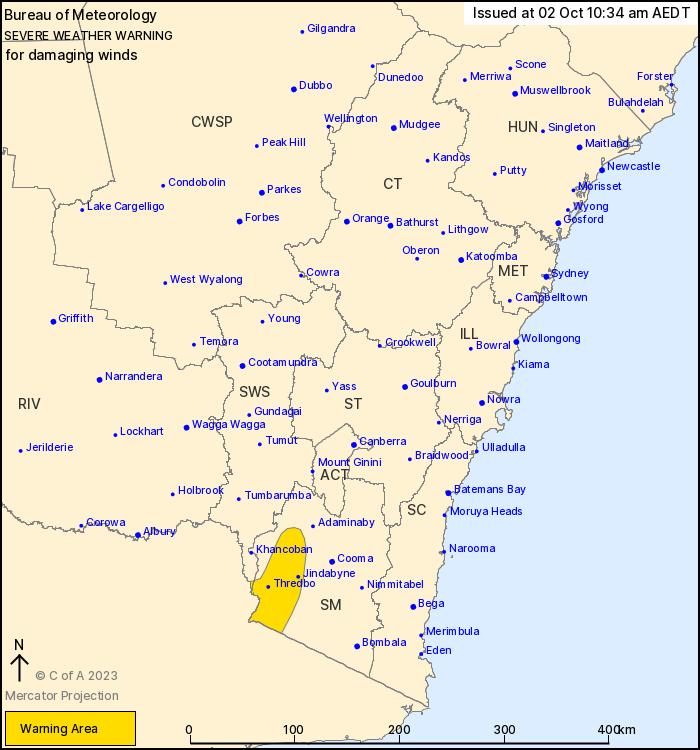
For people in parts of Snowy Mountains and South West Slopes
Forecast Districts.
Issued at 10:34 am Monday, 2 October 2023.
Damaging winds over elevated areas during Tuesday morning.
Weather Situation: Northwesterly winds increase during Tuesday
morning ahead of an approaching upper trough. This upper trough
continues to deepen and develops into a low with an associated
surface low and cold front located over southern and central New
South Wales during Wednesday.
DAMAGING WINDS averaging 60 to 70 km/h with peak gusts in excess
of 90 km/h are likely for parts of the Snowy Mountains above 1500 m
from Tuesday morning.
DAMAGING WINDS averaging 80-90 km/hr with peak gusts up to 130
km/hr are likely over Alpine areas above 1900 m from Tuesday
morning.
Locations which may be affected include Perisher Valley, Charlotte
Pass and Thredbo Top Station.
The State Emergency Service advises that people should:
* Move vehicles under cover or away from trees.
* Secure or put away loose items around your house, yard and
balcony.
* Keep at least 8 metres away from fallen power lines or objects
that may be energised, such as fences.
* Trees that have been damaged by fire are likely to be more
unstable and more likely to fall.
* Report fallen power lines to either Ausgrid (131 388), Endeavour
Energy (131 003), Essential Energy (132 080) or Evoenergy (131 093)
as shown on your power bill.
* Stay vigilant and monitor conditions. Note that the landscape
may have changed following bushfires.
* For emergency help in floods and storms, ring your local SES
Unit on 132 500.
01/Oct/2023 11:44 PM


