
Source: Bureau of Meteorology
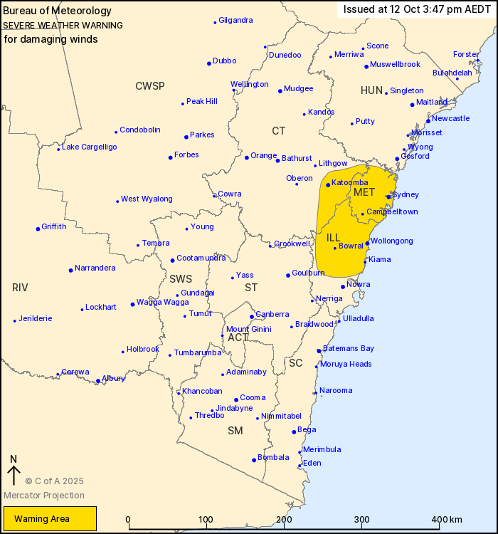
For people in Metropolitan and parts of Illawarra and Central
Tablelands Forecast Districts.
Issued at 3:47 pm Sunday, 12 October 2025.
Damaging winds in the Greater Sydney and Wollongong regions.
Weather Situation: A strong west to northwesterly flow has
developed in response to an approaching front from the south,
affecting Greater Sydney, Wollongong, the Southern Highlands and
the Blue Mountains. Winds ease below warning thresholds early this
evening.
DAMAGING WINDS averaging 55 to 65 km/h with peak gusts around 90
km/h are expected to continue for the next few hours before easing
early this evening.
Locations which may be affected include Sydney, Wollongong,
Bowral, Katoomba, Campbelltown and Kiama.
A 102 km/h gust was recorded at Sydney Airport at 3:21 pm.
A 91 km/h gust was recorded at Port Kembla at 2:47 pm.
The State Emergency Service advises that people should:
* Move vehicles under cover or away from trees.
* Secure or put away loose items around your house, yard and
balcony.
* Keep at least 8 metres away from fallen power lines or objects
that may be energised, such as fences.
* Trees that have been damaged by fire are likely to be more
unstable and more likely to fall.
* Report fallen power lines to either Ausgrid (131 388), Endeavour
Energy (131 003), Essential Energy (132 080) or Evoenergy (131 093)
as shown on your power bill.
* Stay vigilant and monitor conditions. Note that the landscape
may have changed following bushfires.
* For emergency help in floods and storms, ring your local SES
Unit on 132 500.
12/Oct/2025 04:57 AM


