
Source: Bureau of Meteorology
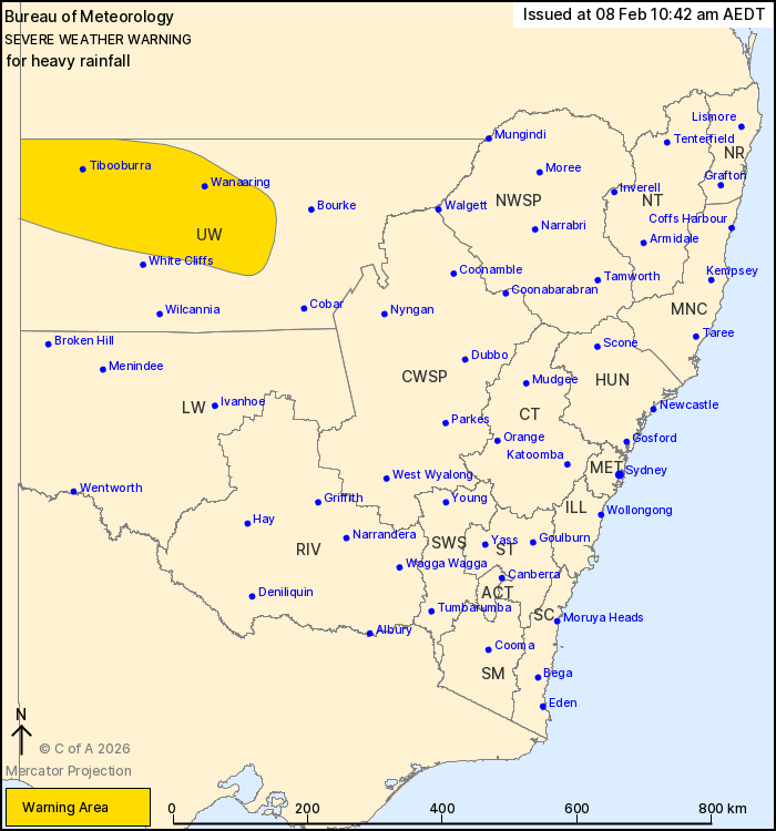
For people in parts of Upper Western Forecast District.
Issued at 10:42 am Sunday, 8 February 2026.
Heavy rainfall redeveloping about parts of the Upper Western
overnight.
Weather Situation: A humid tropical airmass lingers over
northwestern New South Wales. Areas of heavy rain are expected to
develop about the Upper Western overnight and into Monday morning
as an upper trough approaches the area.
HEAVY RAINFALL which may lead to FLASH FLOODING is forecast to
redevelop in parts of the Upper Western district from late Sunday
night or early Monday morning. Six-hourly rainfall totals between
20 and 50 mm are likely, with localised totals up to 75 mm possible
with thunderstorm activity.
Conditions are expected to ease by early Monday afternoon.
Locations which may be affected include Tibooburra, Wanaaring,
Louth and Milparinka.
Severe weather is no longer occurring in the Lower Western
district and the warning for this district is CANCELLED.
The State Emergency Service advises that people should:
* Don't drive, ride or walk through flood water.
* Keep clear of creeks and storm drains.
* If you are trapped by flash flooding, seek refuge in the highest
available place and ring 000 if you need rescue.
For emergency help in flood and storms, ring the SES on 132
500.
Stay updated on the Hazards Near Me NSW app or the ACT ESA website
(https://esa.act.gov.au).
07/Feb/2026 11:47 PM


