
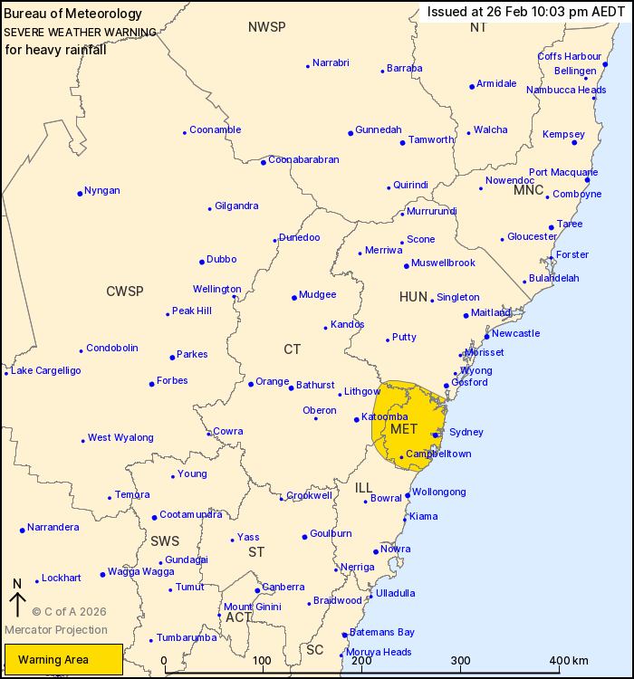
Source: Bureau of Meteorology
For people in Metropolitan and parts of Illawarra, Central
Tablelands and Hunter Forecast Districts.
Issued at 10:03 pm Thursday, 26 February 2026.
Heavy rainfall continues through Sydney and adjacent areas
overnight, easing early on Friday morning.
Weather Situation: A slow moving trough has stalled about the
Sydney Metropolitan area is bringing persistent heavy showers and
isolated thunderstorms onshore to the area.
HEAVY RAINFALL which may lead to FLASH FLOODING is possible
throughout the Sydney Metropolitan area and in adjacent parts of
the Blue Mountains, Hunter and northern Illawarra overnight. Three
to six-hourly rainfall totals between 40 and 80 mm are
possible.
Heavy rainfall is expected to ease below warning thresholds early
tomorrow morning as the trough weakens.
Locations which may be affected include Sydney, Campbelltown,
Penrith, Parramatta and Springwood.
109.0 MM WAS RECORDED AT LIDCOMBE IN THE 6 HOURS TO 9:45 PM.
67.0 mm was recorded at Guildford in the 3 hours to 8:48 pm.
65.8 mm was recorded at Horsley Park in the 3 hours to 8:37
pm.
71.6 mm was recorded at Bankstown Airport in the 3 hours to 8:23
pm.
55.0 mm was recorded at Liverpool in the 3 hours to 8:15 pm.
71.0 mm was recorded at Canterbury in the 3 hours to 8:06
pm.
The State Emergency Service advises that people should:
* Don't drive, ride or walk through flood water.
* Keep clear of creeks and storm drains.
* If you are trapped by flash flooding, seek refuge in the highest
available place and ring 000 if you need rescue.
For emergency help in flood and storms, ring the SES on 132
500.
Stay updated on the Hazards Near Me NSW app or the ACT ESA website
(https://esa.act.gov.au).
26/Feb/2026 11:05 AM

