
Source: Bureau of Meteorology
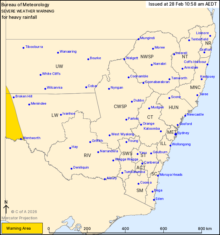
For people in parts of Lower Western and Upper Western Forecast
Districts.
Issued at 10:58 am Saturday, 28 February 2026.
Heavy rainfall developing about the far southwest tonight.
Weather Situation: Tropical humidity on the southeastern flank of
a low in central Australia is expected to increase tonight leading
to the development of a broad region of rain with embedded
thunderstorms. Rain rates may ease for a period during the day on
Sunday, before increasing overnight into Monday with the approach
of a cold front.
HEAVY RAINFALL which may lead to FLASH FLOODING is forecast for
the far southwestern parts of the Lower Western and Upper Western
forecast districts overnight tonight, however is more likely from
Sunday evening. Six-hourly rainfall totals between 40 to 60 mm are
possible.
Locations which may be affected include Wentworth.
The State Emergency Service advises that people should:
* Don't drive, ride or walk through flood water.
* Keep clear of creeks and storm drains.
* If you are trapped by flash flooding, seek refuge in the highest
available place and ring 000 if you need rescue.
For emergency help in flood and storms, ring the SES on 132
500.
Stay updated on the Hazards Near Me NSW app or the ACT ESA website
(https://esa.act.gov.au).
28/Feb/2026 12:22 AM

