Source: Bureau of Meteorology
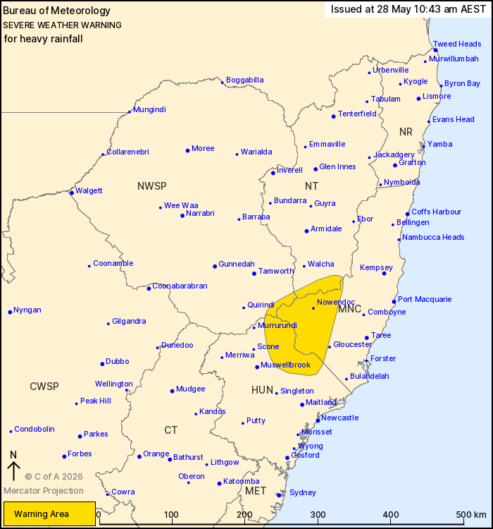
For people in parts of Mid North Coast, Hunter, North West Slopes
and Plains and Northern Tablelands Forecast Districts.
Issued at 10:43 am Thursday, 28 May 2026.
Heavy rainfall possible about the elevated Mid North Coast from
early this evening.
Weather Situation: A low is expected to form today over northeast
NSW and move offshore off the Mid North Coast tonight in response
to an upper trough. Elevated moisture and enhanced flow into
topography is expected to bring heavy rainfall to elevated areas of
the Mid North Coast and surrounds. The low moves away from the
coast during Friday afternoon.
HEAVY RAINFALL which may lead to FLASH FLOODING is possible about
elevated parts of the southern Mid North Coast, Upper Hunter, and
adjacent districts from this afternoon. 6-hourly rainfall totals
between 40 and 70 mm are possible, with isolated falls up to 80
mm.
Rainfall is expected to ease below warning thresholds during
Friday afternoon.
Severe thunderstorms are possible for northeast NSW on Thursday
and Friday. A Severe Thunderstorm Warning will be issued if severe
thunderstorms are detected.
Flood watches are current for rivers in the area. Please refer to
https://www.bom.gov.au/weather-and-climate/warnings-and-alerts for
more detail.
Locations which may be affected include Nowendoc, Barrington Tops
and Yarrowitch.
The State Emergency Service advises that people should:
* Don't drive, ride or walk through flood water.
* Keep clear of creeks and storm drains.
* If you are trapped by flash flooding, seek refuge in the highest
available place and ring 000 if you need rescue.
For emergency help in flood and storms, ring the SES on 132
500.
Stay updated on the Hazards Near Me NSW app or the ACT ESA website
(https://esa.act.gov.au).
28/May/2026 12:47 AM