
Source: Bureau of Meteorology
Issued at 1:21 pm ACST on Thursday 19 February 2026 Flood Watch
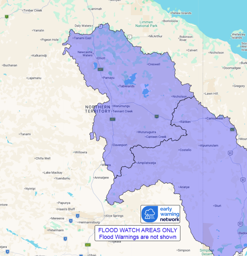
Number: 1
RIVER LEVEL RISES AND AREAS OF FLOODING IS POSSIBLE ACROSS THE
FLOOD WATCH AREA FROM SATURDAY
A trough sits over central parts of the Northern Territory,
building moisture across central and southern districts, and a low
is expected to develop within the trough over the coming days. This
is expected to bring thunderstorms and widespread rainfall across
the Flood Watch Area, with the risk of isolated heavier falls. This
rainfall may result in river and creek level rises and areas of
flooding from Saturday in the Barkly and Georgina River
catchments.
Catchments are wet across the Flood Watch Area.
River level rises, localised flooding, and overland inundation are
possible across parts of the Flood Watch Area, which may affect
road access. Some communities may become isolated. Check road
conditions before travelling.
Catchments likely to be affected include:
Georgina River and Eyre Creek
Barkly (for southern areas)
For the latest flood and weather warnings see
www.bom.gov.au/weather-and-climate/warnings-and-alerts
For the latest rainfall and river level information see
www.bom.gov.au/australia/flood
Safety Advice:
* Don't drive, walk, swim or play in floodwater because it is
dangerous.
* Stay away from flooded drains, rivers, streams and
waterways.
* Obey road closure signs. Plan ahead so you don't drive on
flooded roads.
* Check the ABC and local media for updates. The situation can
change quickly, so stay informed.
* For local emergency management warnings and advice visit
www.securent.nt.gov.au.
Rainfall and River
Conditions Map
19/Feb/2026 04:11 AM

