
Source: Bureau of Meteorology
Issued at 11:37 pm Saturday, 18 November 2023.
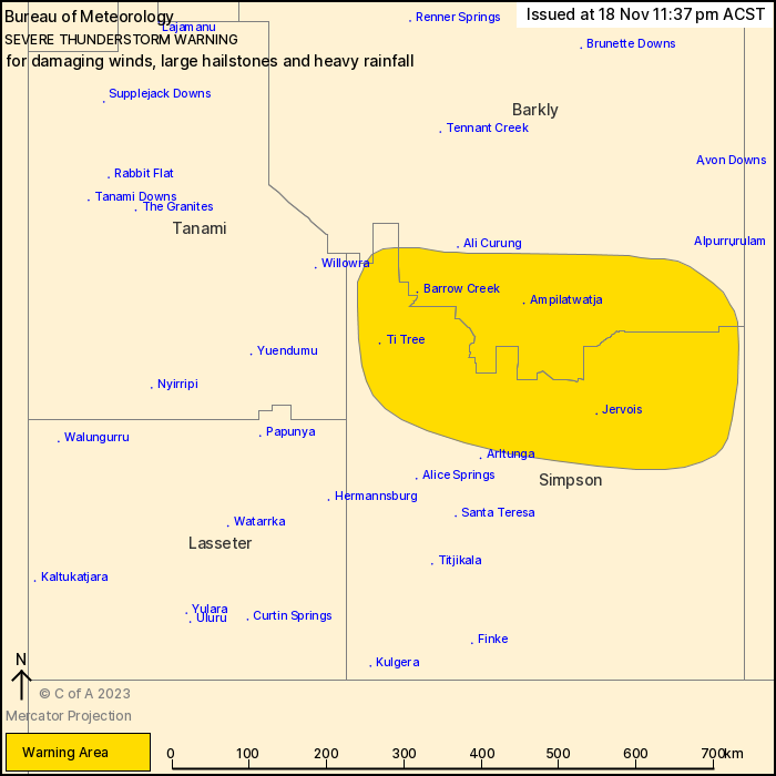
Severe thunderstorms continue to move across the south of the
Territory.
Weather Situation: An unstable airmass remains over the south with
a strong jet stream leading to the development of severe
thunderstorms across the Simpson and southern Barkly districts
overnight
Severe thunderstorms are likely to produce damaging winds, large
hailstones and heavy rainfall that may lead to flash flooding in
the warning area over the next several hours. Locations which may
be affected include Ti Tree, Jervois, Barrow Creek, Ampilatwatja
and Simpson District east of Finke.
102km/h wind gust was recorded at Rabbit Flat at 4:04pm
The Northern Territory Emergency Service advises that people
should:
* slow down and turn your headlights on
* create your own sandbags if there is flooding, by using pillow
cases or shopping bags filled with sand and place them around
doorways to protect your home
* secure loose outside objects
* ensure pets and animals are safe
* avoid remaining in the open when storms threaten
* pull over if it is raining heavily and you cannot see, park with
your hazard lights on until the rain clears
* avoid driving into water of unknown depth and current
* for emergency help in floods, storms and cyclones, contact the
NTES on 132 500. For more safety tips visit
www.securent.nt.gov.au
18/Nov/2023 02:16 PM

