
Source: Bureau of Meteorology
Issued at 1:08 pm AEST on Saturday 24 January 2026 Flood Watch
Number: 2
HEAVY RAINFALL AND RIVER LEVEL RISES OCCURRING ACROSS PARTS OF THE
WESTERN CAPE YORK PENINSULA
INCREASED FLOODING POSSIBLE FROM SATURDAY ACROSS THE WESTERN CAPE
YORK PENINSULA, EXTENDING TO GULF CATCHMENTS EARLY NEXT WEEK
FLOODING POSSIBLE ALONG THE NORTH EAST COASTAL RIVERS FROM
MONDAY
A tropical low embedded within the monsoon trough has produced
heavy rainfall across parts of the western Cape York Peninsula.
Kowanyama Airport recorded 306 mm in the 24 hours to 9:00 am
Saturday, resulting in major flooding along Magnificent Creek at
Kowanyama.
Further heavy rainfall is expected to continue across western Cape
York Peninsula catchments, extending into parts of Gulf of
Carpentaria catchments early next week. This rainfall may lead to
new and renewed flooding, particularly where catchments are
saturated and river levels are already elevated.
In addition, moderate to heavy rainfall to the north east coast
from Sunday.
Catchments in this region remain wet to saturated following recent
rainfall and flooding, and further rainfall may result in rapid
river rises and flooding.
Catchments within the Flood Watch area are generally wet to
saturated. Elevated river levels and areas of flooding are already
occurring in some locations, and rivers and creeks are expected to
respond quickly to any additional rainfall.
New and renewed flooding is possible from Saturday and into early
next week across the Flood Watch area.
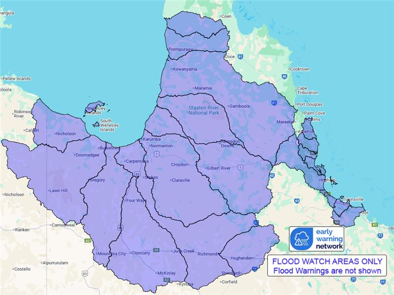
Catchments likely to be affected include:
Mulgrave and Russell Rivers
Johnstone River
Tully River
Murray River
Herbert River
Black River
Ross and Bohle Rivers
Haughton River
Settlement Creek
Nicholson River
Leichhardt River
Upper Flinders River
Lower Flinders River
Cloncurry River
Norman River
Gilbert River
Staaten River
Mitchell River (major flooding occurring on Magnificent
Creek)
Coleman and Edward Rivers
Holroyd and Kendall Rivers
A Severe Weather Warning is current for parts of the Gulf Country.
Flood warnings are current for the following catchment(s) :
Nicholson, Lower Flinders and Norman.
For the latest flood and weather warnings see
www.bom.gov.au/weather-and-climate/warnings-and-alerts
For the latest rainfall and river level information see
www.bom.gov.au/australia/flood
Safety Advice:
* Don't drive, walk, swim or play in floodwater because it is
dangerous.
* Stay away from flooded drains, rivers, streams and
waterways.
* Obey road closure signs. Plan ahead so you don't drive on
flooded roads.
* Check the ABC and local media for updates. The situation can
change quickly, so stay informed.
* For local emergency management warnings and advice visit
www.disaster.qld.gov.au/warnings.
For emergency assistance call SES on telephone number 132 500. In
life-threatening emergencies, call 000 (triple zero)
immediately.
Rainfall and River
Conditions Map
24/Jan/2026 03:22 AM

