
Source: Bureau of Meteorology
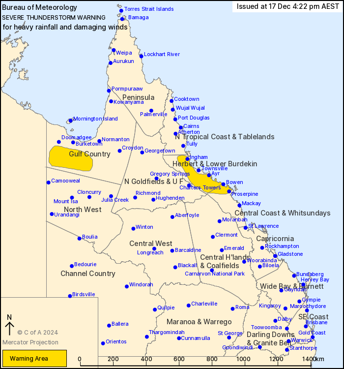
For people in parts of Gulf Country, Herbert and Lower Burdekin
and Central Coast and Whitsundays Forecast Districts.
Issued at 4:22 pm Tuesday, 17 December 2024.
Thunderstorms with heavy rainfall over the NE tropics. Damaging
winds possible over the Gulf Country.
Weather Situation: A very moist unstable atmosphere in combination
with an upper low pressure system is triggering thunderstorms with
heavy rainfall about parts of the Central Coast and Herbert and
Lower Burdekin districts. Other thunderstorms with possible
damaging wind gusts are forming north of a surface trough across
northwestern Queensland.
Severe thunderstorms are likely to produce heavy rainfall that may
lead to flash flooding over the next several hours in parts of the
Herbert and Lower Burdekin and Central Coast and Whitsundays
districts. Locations which may be affected include Proserpine,
Bowen, Ingham, Ayr, Mingela, Giru, Abergowrie, Airlie Beach and
Clare.
Severe thunderstorms are likely to produce damaging winds over the
next several hours in parts of the Gulf Country district. Locations
which may be affected include Augustus Downs Station, Riversleigh
Station, Donors Hill Station, Gregory Downs Station and Lawn
Hill.
91 km/h wind gust recorded at Century Mine at 4:11 pm.
55mm recorded in the 30 minutes to 4:05 pm at Peter Faust
Dam.
Emergency services advise people to:
* Park your car undercover away from trees.
* Close doors and windows.
* Keep asthma medications close by. Storms and wind can trigger
asthma attacks.
* Charge mobile phones and power banks in case the power goes
out.
* Put your pets somewhere safe and make sure they can be
identified in case they get lost.
* Do not drive now unless you have to because conditions are
dangerous.
* Tell friends, family and neighbours in the area.
* Go inside a strong building now. Stay inside until the storm has
passed.
17/Dec/2024 06:32 AM

