Source: Bureau of Meteorology
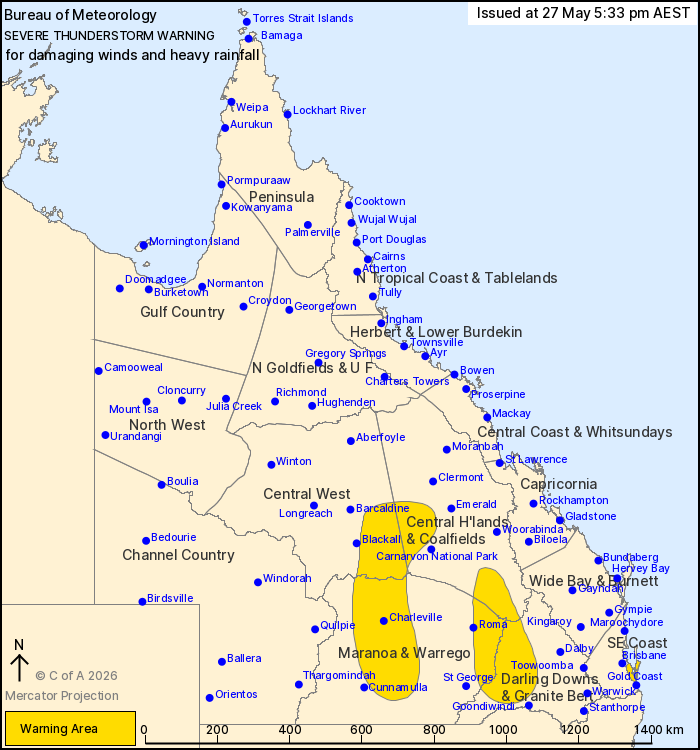
For people in parts of Central Highlands and Coalfields, Central
West, Maranoa and Warrego, Darling Downs and Granite Belt and
Southeast Coast Forecast Districts.
Issued at 5:33 pm Wednesday, 27 May 2026.
Severe thunderstorms about the southern interior and
southeast.
Weather Situation: A deepening trough over the interior of the
state is expected to gradually move east today. Moisture has
increased to the east of the trough due to a persistent moist
northeasterly airstream, supporting the development of
thunderstorms. These storms may bring locally heavy rainfall and
damaging winds to parts of the southern interior and southeastern
areas of the state.
Severe thunderstorms are likely to produce damaging winds and
heavy rainfall that may lead to flash flooding over the next
several hours in parts of the Central Highlands and Coalfields,
Central West, Maranoa and Warrego and Darling Downs and Granite
Belt districts. Locations which may be affected include
Charleville, Tambo, Tara, Bogantungan, Jericho and Miles.
Severe thunderstorms are likely to produce heavy rainfall that may
lead to flash flooding over the next several hours in parts of the
Southeast Coast district. Locations which may be affected include
Cleveland, Beenleigh and North Stradbroke Island.
50 mm of rainfall recorded at Dayboro in the 30 minutes to 3:55
pm.
Emergency services advise people to:
* Park your car undercover away from trees.
* Close doors and windows.
* Keep asthma medications close by. Storms and wind can trigger
asthma attacks.
* Charge mobile phones and power banks in case the power goes
out.
* Put your pets somewhere safe and make sure they can be
identified in case they get lost.
* Do not drive now unless you have to because conditions are
dangerous.
* Tell friends, family and neighbours in the area.
* Go inside a strong building now. Stay inside until the storm has
passed.
27/May/2026 07:39 AM