
Source: Bureau of Meteorology
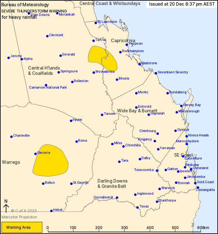
For people in parts of Central Highlands and Coalfields,
Capricornia and Maranoa and Warrego Forecast Districts.
Issued at 8:37 pm Wednesday, 20 December 2023.
Severe thunderstorms ongoing but becoming more isolated.
Weather Situation: Severe thunderstorms developed along a trough
in a humid airmass through the interior of Queensland this
afternoon and are ongoing this evening.
Severe thunderstorms are likely to produce heavy rainfall that may
lead to flash flooding in the warning area over the next several
hours. Locations which may be affected include Duaringa.
Severe thunderstorms are no longer occurring in the Gulf Country,
Northern Goldfields and Upper Flinders, North West, Central West,
Wide Bay and Burnett, Darling Downs and Granite Belt and Southeast
Coast districts and the warning for these districts is
CANCELLED.
100 km/h wind gust recorded at Cloncurry Airport at 4:11 pm.
98 km/h wind gust recorded at Julia Creek Airport at 5:23
pm.
72.0 mm recorded at Moogerah Dam in the one hour to 6:18 pm.
46.0 mm recorded at Ravenscourt Alert (NW of Charleville) in one
hour to 3:20 pm.
43.0 mm recorded at Charleville in one hour to 3:51 pm.
41.5 mm recorded at Cherbourg in 30 minutes to 6:28 pm.
Emergency services advise people to:
* Park your car undercover away from trees.
* Close doors and windows.
* Keep asthma medications close by. Storms and wind can trigger
asthma attacks.
* Charge mobile phones and power banks in case the power goes
out.
* Put your pets somewhere safe and make sure they can be
identified in case they get lost.
* Do not drive now unless you have to because conditions are
dangerous.
* Tell friends, family and neighbours in the area.
* Go inside a strong building now. Stay inside until the storm has
passed.
20/Dec/2023 10:43 AM

