
Source: Bureau of Meteorology
For people in parts of Southeast Coast Forecast District.
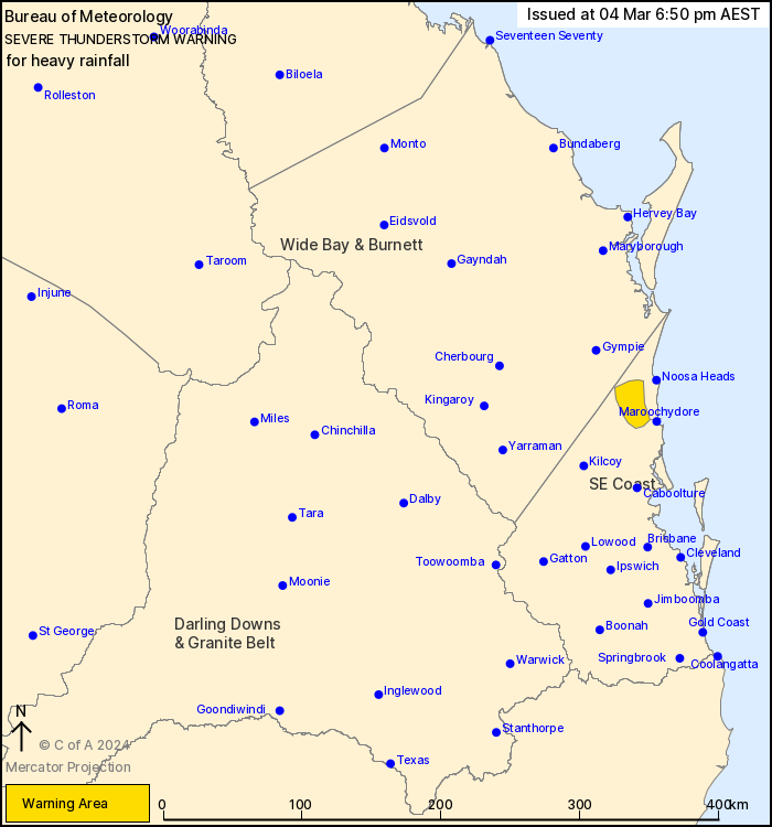
Issued at 6:50 pm Monday, 4 March 2024.
Isolated heavy rainfall with thunderstorms remains possible over
the Sunshine Coast hinterland.
Weather Situation: A trough moving across southeast Queensland
this afternoon is triggering severe thunderstorms, aided by a weak
upper trough.
Severe thunderstorms are likely to produce localised heavy
rainfall that may lead to flash flooding in the warning area over
the next hour or two. Locations which may be affected include
Cooroy and Nambour.
Severe thunderstorms are no longer occurring in the Central
Highlands and Coalfields, Wide Bay and Burnett, Maranoa and Warrego
and Darling Downs and Granite Belt districts and the warning for
these districts is CANCELLED.
Emergency services advise people to:
* Park your car undercover away from trees.
* Close doors and windows.
* Keep asthma medications close by. Storms and wind can trigger
asthma attacks.
* Charge mobile phones and power banks in case the power goes
out.
* Put your pets somewhere safe and make sure they can be
identified in case they get lost.
* Do not drive now unless you have to because conditions are
dangerous.
* Tell friends, family and neighbours in the area.
* Go inside a strong building now. Stay inside until the storm has
passed.
04/Mar/2024 08:57 AM


