
Source: Bureau of Meteorology
For people in parts of Southeast Coast Forecast District.
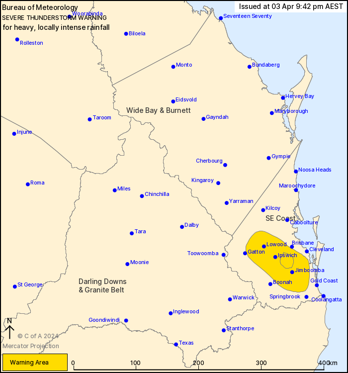
Issued at 9:42 pm Wednesday, 3 April 2024.
SLOW MOVING STORMS WITH INTENSE RAINFALL CONTINUES BETWEEN IPSWICH
AND LOGAN.
Weather Situation: Isolated thunderstorms embedded within a band
of persistent heavy showers is situated along a trough in the
southeast of the state. Thunderstorms are slow moving and will
likely continue into the late evening.
VERY DANGEROUS THUNDERSTORMS are likely to produce heavy, locally
intense rainfall that may lead to dangerous and life-threatening
flash flooding over the next several hours in parts of the
Southeast Coast district.
Severe thunderstorms are likely to produce heavy rainfall that may
lead to flash flooding over the next several hours in parts of the
Southeast Coast district. Locations which may be affected include
Ipswich, Beenleigh, Beaudesert, Jimboomba, Laidley, Lowood and
Mount Tamborine.
108.0 MM WAS RECORDED IN THE 1 HOUR TO 9:09 PM AT JINGLE
DOWNS.
103.0 MM WAS RECORDED IN THE 1 HOUR TO 9:39 PM AT GREENBANK
(Thompson Rd)
77.8 mm was recorded in the 2 hours to 9:32 pm at Lyons.
71.0 mm was recorded in the 2 hours to 8:15 pm at Kalbar.
81.0 mm was recorded in 1 hour to 7:22 pm at Coulson
Crossing.
Emergency services advise people to:
* If you have children make sure they are with you or an adult you
trust.
* Park your car undercover away from trees.
* Close doors and windows.
* Keep asthma medications close by. Storms and wind can trigger
asthma attacks.
* Charge mobile phones and power banks in case the power goes
out.
* Put your pets somewhere safe and make sure they can be
identified in case they get lost.
* Do not drive now unless you have to because conditions are
dangerous.
* Tell friends, family and neighbours in the area.
* Go inside a strong building now. Stay inside until the storm has
passed.
03/Apr/2024 11:49 AM


