
Source: Bureau of Meteorology
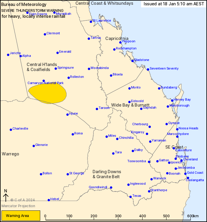
For people in parts of Central Highlands and Coalfields and
Maranoa and Warrego Forecast Districts.
Issued at 5:10 am Thursday, 18 January 2024.
INTENSE RAINFALL WITH VERY DANGEROUS THUNDERSTORMS ON THE
CARNARVON RANGES.
Weather Situation: Severe thunderstorms continue to trigger along
a trough in the southeast of the state, fuelled by very moist
northeasterly winds.
VERY DANGEROUS THUNDERSTORMS are likely to produce heavy, locally
intense rainfall that
may lead to dangerous and life-threatening flash flooding in the
warning area over the next several hours.
129 mm at Mt Tabor in 2 hours to 5:00 am.
93 mm at Upper Warrego Alert in 3 hours to 4:00 am.
81 mm at Barngo Crossing in 2 hours to 5:00 am.
Emergency services advise people to:
* If you have children make sure they are with you or an adult you
trust.
* Park your car undercover away from trees.
* Close doors and windows.
* Keep asthma medications close by. Storms and wind can trigger
asthma attacks.
* Charge mobile phones and power banks in case the power goes
out.
* Put your pets somewhere safe and make sure they can be
identified in case they get lost.
* Do not drive now unless you have to because conditions are
dangerous.
* Tell friends, family and neighbours in the area.
* Go inside a strong building now. Stay inside until the storm has
passed.
17/Jan/2024 07:17 PM

