
Source: Bureau of Meteorology
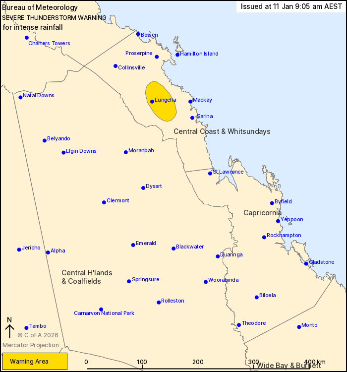
For people in parts of Central Coast and Whitsundays Forecast
District.
Issued at 9:05 am Sunday, 11 January 2026.
INTENSE RAINFALL IS EXPECTED INLAND OF MACKAY THIS MORNING.
Weather Situation: Convergent bands from Tropical Cyclone Koji are
expected to generate intense rainfall on the Central Coast inland
Mackay this morning.
VERY DANGEROUS THUNDERSTORMS are likely to produce intense
rainfall that may lead to dangerous and life-threatening flash
flooding in the warning area over the next several hours. Locations
which may be affected include Eungella.
A separate Severe Weather Warning and forecast track map
associated with Tropical Cyclone Koji is current for the northeast
tropical coast. Several flood watches and warnings are also current
for large parts of Queensland. Please refer to
https://www.bom.gov.au/weather-and-climate/warnings-and-alerts
Significant observations to 9 am AEST:
146 MM AT MATTIE O'NEIL BRIDGE IN THE 2 HOURS TO 8:58 AM.
73 mm at Netherdale in the 1 hour to 8:40 am.
87 mm at Stafford Crossing in the 1 hour to 7:18 am.
138 mm at Clarke Range in the 3 hours to 8:30 am.
112 mm at Eungella in the 3 hours to 8:39 am.
167 mm at Peter Faust Dam in the 6 hours to 7:21 am.
Emergency services advise people to:
* If you have children make sure they are with you or an adult you
trust.
* Park your car undercover away from trees.
* Close doors and windows.
* Keep asthma medications close by. Storms and wind can trigger
asthma attacks.
* Charge mobile phones and power banks in case the power goes
out.
* Put your pets somewhere safe and make sure they can be
identified in case they get lost.
* Do not drive now unless you have to because conditions are
dangerous.
* Tell friends, family and neighbours in the area.
* Go inside a strong building now. Stay inside until the storm has
passed.
10/Jan/2026 11:51 PM


