
Source: Bureau of Meteorology
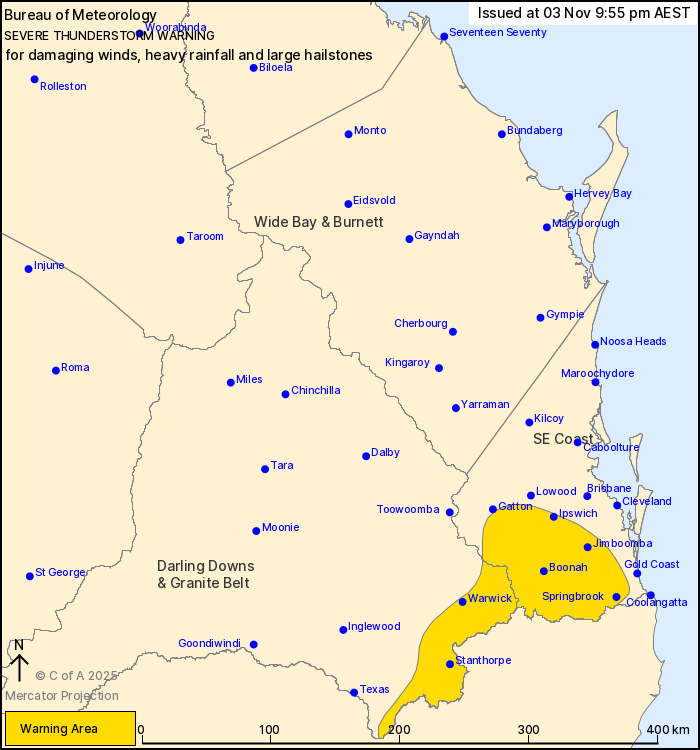
For people in parts of Darling Downs and Granite Belt and
Southeast Coast Forecast Districts.
Issued at 9:55 pm Monday, 3 November 2025.
Severe thunderstorms continue about far southeastern
Queensland.
Weather Situation: A surface trough over the eastern Darling Downs
is moving east this evening into a humid, unstable air mass over
southeast Queensland, generating thunderstorms.
Severe thunderstorms are likely to produce damaging winds, heavy
rainfall that may lead to flash flooding and large hailstones in
the warning area over the next several hours. Locations which may
be affected include Warwick, Stanthorpe, Ipswich, Jimboomba,
Boonah, Springbrook, Mount Tamborine, Beaudesert and Laidley.
Severe thunderstorms are no longer occurring in the Wide Bay and
Burnett district and the warning for this district is
CANCELLED.
96 km/h wind gust recorded at Wellcamp Airport at 8:39 pm.
93 km/h wind gust recorded at Dalby at 7:48 pm.
45mm rainfall recorded in 30 minutes to 5:45 pm at Gilligulgul
(north of Miles).
Wind damage reported in the Warwick and Pratten areas around 5
pm.
96 km/h wind gust was recorded at Roma at 12:12 pm.
Emergency services advise people to:
* Park your car undercover away from trees.
* Close doors and windows.
* Keep asthma medications close by. Storms and wind can trigger
asthma attacks.
* Charge mobile phones and power banks in case the power goes
out.
* Put your pets somewhere safe and make sure they can be
identified in case they get lost.
* Do not drive now unless you have to because conditions are
dangerous.
* Tell friends, family and neighbours in the area.
* Go inside a strong building now. Stay inside until the storm has
passed.
03/Nov/2025 12:06 PM


