
Source: Bureau of Meteorology
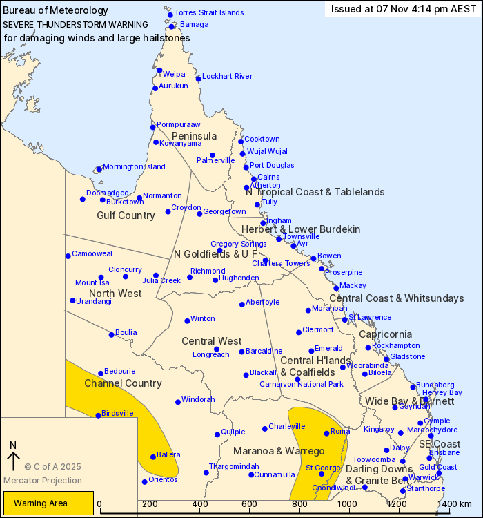
For people in parts of Channel Country, Maranoa and Warrego and
Darling Downs and Granite Belt Forecast Districts.
Issued at 4:14 pm Friday, 7 November 2025.
Severe thunderstorms about parts of southern Queensland
Weather Situation: A dryline lying through southern and central
Queensland combines with an upper trough to trigger thunderstorms
this afternoon and evening. In the southwest another trough in a
hot, unstable airmass is producing thunderstorms capable of
delivering damaging wind gusts,
Severe thunderstorms are likely to produce damaging winds and
large hailstones in the warning area over the next several hours.
Locations which may be affected include Roma, Birdsville, St
George, Ballera, Mitchell and Dirranbandi.
94 km/h wind gust was recorded at Ballera Gas Field at 03:59
pm.
Emergency services advise people to:
* Park your car undercover away from trees.
* Close doors and windows.
* Keep asthma medications close by. Storms and wind can trigger
asthma attacks.
* Charge mobile phones and power banks in case the power goes
out.
* Put your pets somewhere safe and make sure they can be
identified in case they get lost.
* Do not drive now unless you have to because conditions are
dangerous.
* Tell friends, family and neighbours in the area.
* Go inside a strong building now. Stay inside until the storm has
passed.
07/Nov/2025 06:51 AM


