
Source: Bureau of Meteorology
For people in parts of North West Forecast District.
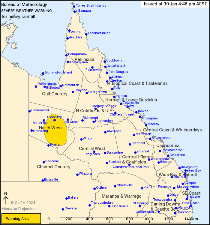
Issued at 4:46 pm Tuesday, 30 January 2024.
Redevelopment of heavy rainfall remains possible across
Queensland's western interior today.
Weather Situation: Ex-Tropical Cyclone Kirrily is currently
located northwest of Middleton. It is forecast to remain
slow-moving across the western interior tonight before shifting to
the north or northwest on Wednesday.
HEAVY RAINFALL which may lead to FLASH FLOODING may continue over
areas between Cloncurry, Middleton and northeast of Boulia tonight
and into tomorrow. 6-hourly rainfall totals between 60 to 120 mm
are possible. 24-hourly rainfall totals between 90 to 180 mm are
also possible.
A Flood Watch and several Flood Warnings are also current for the
Central West, Channel Country and Gulf of Carpentaria catchments.
See http://www.bom.gov.au/qld/warnings/ for more information.
Locations which may be affected include Cloncurry, Dajarra,
Duchess, Selwyn and Mckinlay.
Severe weather is no longer occurring in the Channel Country
district and the warning for this district is CANCELLED.
95 mm recorded at Trepell Airport since 9am Wednesday.
Emergency services advise people to:
* Park your car undercover away from trees.
* Close doors and windows.
* Keep asthma medications close by. Storms and wind can trigger
asthma attacks.
* Charge mobile phones and power banks in case the power goes
out.
* Put your pets somewhere safe and make sure they can be
identified in case they get lost.
* Do not drive now unless you have to because conditions are
dangerous.
* Tell friends, family and neighbours in the area.
* Go inside a strong building now. Stay inside until the storm has
passed.
30/Jan/2024 06:52 AM

