
Source: Bureau of Meteorology
For people in parts of Southeast Coast Forecast District.
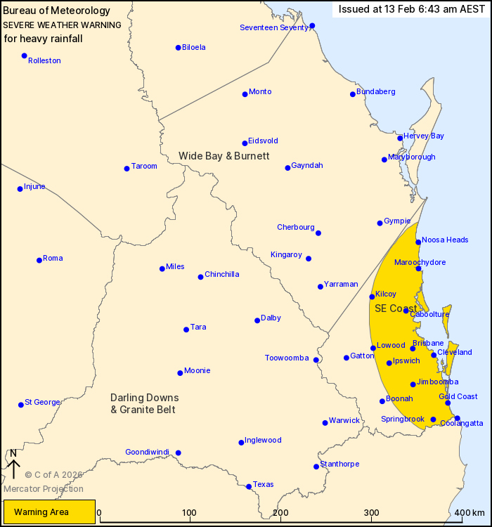
Issued at 6:43 am Friday, 13 February 2026.
Heavy rainfall over southeast Queensland developing from this
morning.
Weather Situation: A southerly wind change is crossing the border
into the South East Coast this morning and will slowly move north
during the day. This combined with high atmospheric moisture and
humid onshore flow is likely to produce persistent rainfall over
parts of the South East Coast today, particularly likely to from
later this morning
HEAVY RAINFALL which may lead to FLASH FLOODING is forecast to
develop about the South East Coast from this morning. Six-hourly
rainfall totals between 50 to 90 mm are likely, with isolated
higher falls to around 150 mm possible.
A separate Severe Thunderstorm Warning will be issued if VERY
DANGEROUS THUNDERSTORMS with INTENSE RAINFALL are detected.
A separate Flood Watch and various Flood Warnings are current at
the time of issue. Please check
https://www.bom.gov.au/weather-and-climate/warnings-and-alerts for
latest information.
Locations which may be affected include Gold Coast, Brisbane,
Maroochydore, Caboolture, Coolangatta, Ipswich, Noosa Heads,
Cleveland and Jimboomba.
Emergency services advise people to:
* Park your car undercover away from trees.
* Close doors and windows.
* Keep asthma medications close by. Storms and wind can trigger
asthma attacks.
* Charge mobile phones and power banks in case the power goes
out.
* Put your pets somewhere safe and make sure they can be
identified in case they get lost.
* Do not drive now unless you have to because conditions are
dangerous.
* Tell friends, family and neighbours in the area.
* Go inside a strong building now. Stay inside until the storm has
passed.
12/Feb/2026 08:59 PM

