
Source: Bureau of Meteorology
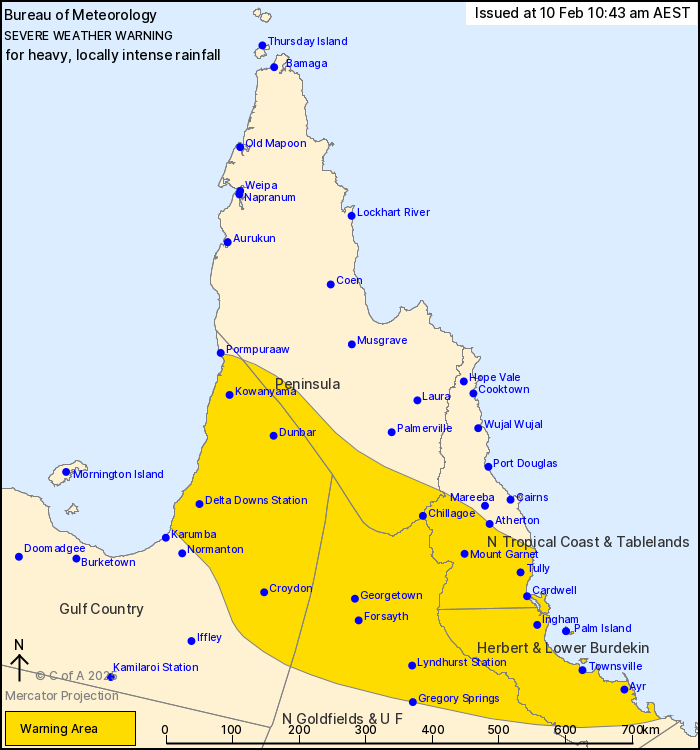
For people in Herbert and Lower Burdekin and parts of Peninsula,
Gulf Country, North Tropical Coast and Tablelands and Northern
Goldfields and Upper Flinders Forecast Districts.
Issued at 10:43 am Monday, 10 February 2025.
Heavy to locally intense rainfall across northern Queensland early
this week.
Weather Situation: Significant rainfall continues about northern
Queensland until early Wednesday, with a low over the Gulf Country
embedded in the monsoon trough, expected to move slowly southeast
over the Northern Goldfields and Upper Flinders into Tuesday.
Enhanced rainfall due to widespread showers and isolated embedded
thunderstorms is possible early this week, with extremely wet soils
and river catchments leading to a higher than normal vulnerability
to flash flooding.
For the Gulf Country, southern Peninsula, Northern Goldfields and
Upper Flinders:
HEAVY RAINFALL which may lead to DANGEROUS AND LIFE-THREATENING
FLASH FLOODING is forecast during Monday and Tuesday. LOCALLY
INTENSE RAINFALL is possible overnight into Tuesday, most likely
over the Northern Goldfields and Upper Flinders. Six-hourly
rainfall totals between 120 to 150 mm are possible. Isolated
24-hourly rainfall totals up to 250 mm are possible.
For the North Tropical Coast and Herbert and Lower Burdekin:
Potential for stronger showers and thunderstorms to produce
localised HEAVY to INTENSE RAINFALL which may lead to DANGEROUS AND
LIFE-THREATENING FLASH FLOODING, most likely developing overnight
into Tuesday. Broader areas of HEAVY RAINFALL are then forecast to
develop later on Monday and into Tuesday. Six-hourly rainfall
totals between 120 to 180 mm are possible during Monday, and could
increase further up to 250 mm on Tuesday morning. Isolated
24-hourly rainfall totals up to 220 mm are possible, with up to 300
mm possible into Tuesday.
A separate Severe Thunderstorm Warning will be issued if very
dangerous thunderstorms with intense rainfall are detected.
Rainfall is forecast to ease across the warning area from early
Wednesday morning.
Heavy rainfall increases the potential for landslides and debris
across roads.
A Flood Watch and various Flood Warnings are current for parts of
Queensland. Please refer to http://www.bom.gov.au/qld/warnings for
more information.
Locations which may be affected include Townsville, Georgetown,
Palm Island, Ingham, Croydon and Kowanyama.
Emergency services advise people to:
* If you have children make sure they are with you or an adult you
trust.
* Park your car undercover away from trees.
* Close doors and windows.
* Keep asthma medications close by. Storms and wind can trigger
asthma attacks.
* Charge mobile phones and power banks in case the power goes
out.
* Put your pets somewhere safe and make sure they can be
identified in case they get lost.
* Do not drive now unless you have to because conditions are
dangerous.
* Tell friends, family and neighbours in the area.
* Go inside a strong building now. Stay inside until the storm has
passed.
10/Feb/2025 12:52 AM

