
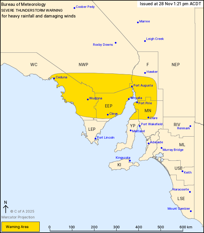
Source: Bureau of Meteorology
For people in Eastern Eyre Peninsula and parts of West Coast,
Yorke Peninsula, Flinders, Mid North and North West Pastoral
districts.
Issued at 1:21 pm Friday, 28 November 2025.
Thunderstorms with possible heavy rain and damaging winds moving
across Eyre Peninsula.
Weather Situation: A cold front advancing inland and eastwards is
triggering isolated severe thunderstorms within a favourable
environment. Severe thunderstorms are expected to continue
throughout the afternoon and evening across the state and further
severe thunderstorm warnings are likely.
Severe thunderstorms are likely to produce heavy rainfall that may
lead to flash flooding and damaging winds in the warning area over
the next several hours. Locations which may be affected include
Whyalla, Ceduna, Port Augusta, Port Pirie, Clare and Wudinna.
The State Emergency Service advises that people should:
* Secure or put away loose items around your property.
* Move cars under cover or away from trees.
* Keep clear of fallen power lines.
* Don't drive, ride or walk through flood water.
* Keep clear of creeks and storm drains.
* Stay indoors, away from windows, while storms are nearby.
28/Nov/2025 02:56 AM

