
Source: Bureau of Meteorology
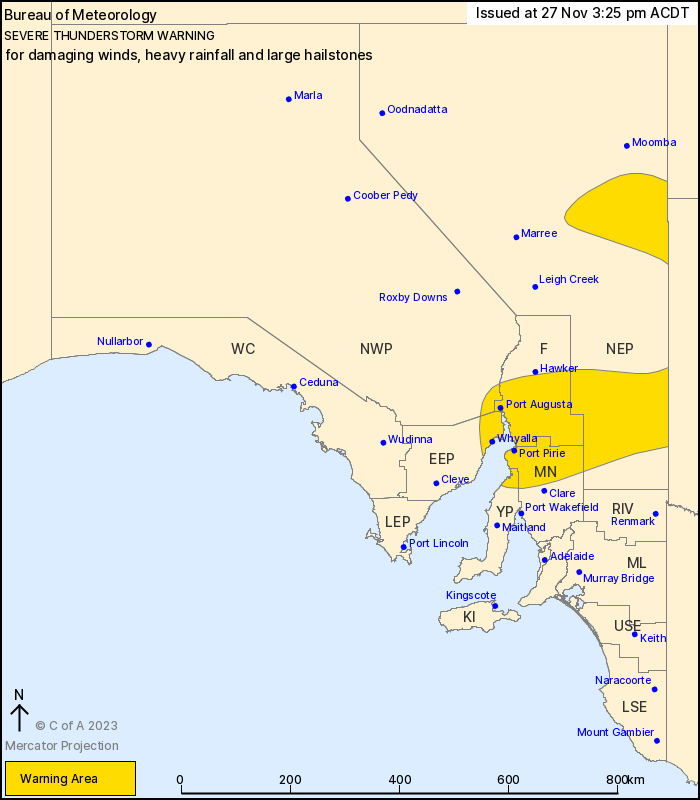
For people in parts of Eastern Eyre Peninsula, Yorke Peninsula,
Flinders, Mid North, North East Pastoral and North West Pastoral
districts.
Issued at 3:25 pm Monday, 27 November 2023.
Severe thunderstorms over eastern parts of South Australia this
afternoon and evening.
Weather Situation: Unstable conditions near and southeast of a
trough which extends from near the NSW/Qld border to the Lower Eyre
Peninsula in combination with a strengthening upper system is
assisting thunderstorm development this afternoon and
evening.
Severe thunderstorms are likely to produce damaging winds, heavy
rainfall that may lead to flash flooding and large hailstones in
the warning area over the next several hours. Locations which may
be affected include Whyalla, Port Augusta, Port Pirie, Jamestown,
Peterborough and Olary.
The State Emergency Service advises that people should:
* Secure or put away loose items around your property.
* Move cars under cover or away from trees.
* Keep clear of fallen power lines.
* Don't drive, ride or walk through flood water.
* Keep clear of creeks and storm drains.
* Stay indoors, away from windows, while storms are nearby.
27/Nov/2023 05:01 AM

