
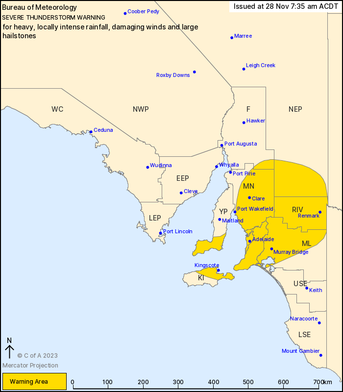
Source: Bureau of Meteorology
For people in Adelaide Metropolitan, Mount Lofty Ranges, Mid
North, Riverland and parts of Yorke Peninsula, Kangaroo Island,
Murraylands, Flinders, Upper South East and North East Pastoral
districts.
Issued at 7:35 am Tuesday, 28 November 2023.
Heavy, locally INTENSE RAINFALL about the Adelaide metro. Damaging
winds, locally with large hailstones possible over Riverlands,
Murraylands, North East Pastoral districts.
Weather Situation: An upper level low over South Australia is
maintaining unstable conditions, with thunderstorm development
continuing through the morning.
Severe thunderstorms are likely to produce heavy, locally intense
rainfall that may lead to dangerous and life-threatening flash
flooding, damaging winds, with some severe thunderstorms capable of
producing large hailstones in the warning area over the next
several hours. Locations which may be affected include Adelaide,
Renmark, Clare, Murray Bridge, Kingscote and Jamestown.
SCOTCH COLLEGE RECORDED 45.8MM IN THE 1 HR TO 07:02AM
Kapinda (Mingays Waterhole) recorded 31.4mm in the 1 hr to
06:51am.
Ridge Park recorded 35.2mm in the 2 hrs to 07:30am
Belair (St Johns) recorded 35.6mm in the 2 hrs to 07:28am.
Bellevue Heights recorded 38.6mm in the 2 hrs to 07:31am.
The State Emergency Service advises that people should:
* Secure or put away loose items around your property.
* Move cars under cover or away from trees.
* Keep clear of fallen power lines.
* Don't drive, ride or walk through flood water.
* Keep clear of creeks and storm drains.
* Stay indoors, away from windows, while storms are nearby.
27/Nov/2023 09:20 PM

