
Source: Bureau of Meteorology
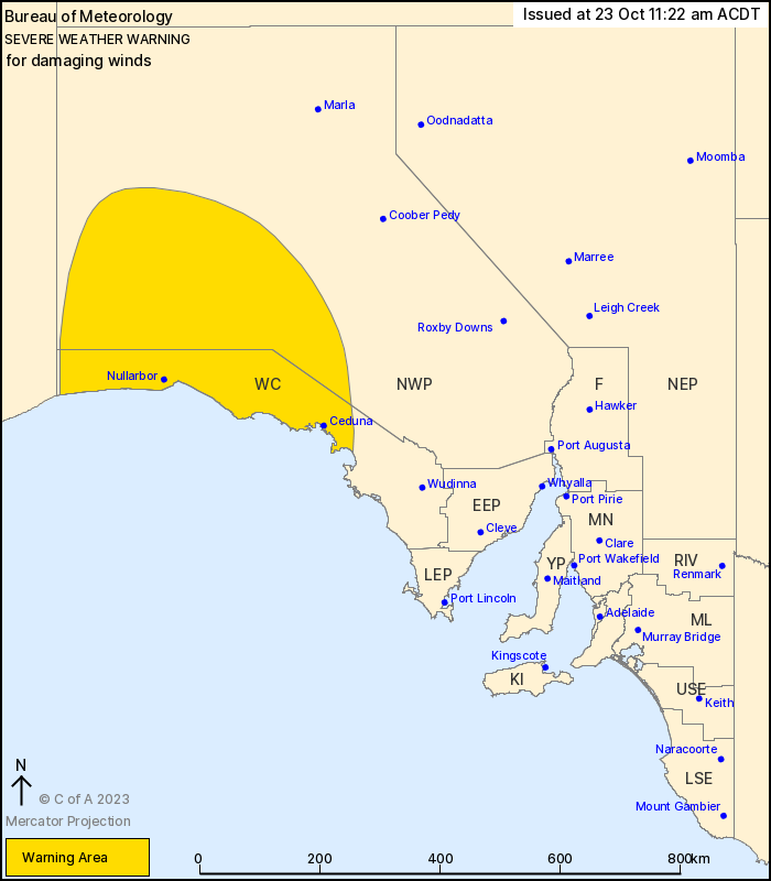
For people in West Coast and parts of North West Pastoral
districts.
Issued at 11:22 am Monday, 23 October 2023.
Damaging wind gusts possible with the passage of a cold front this
afternoon.
Weather Situation: A strong cold front will cross the west of the
state this afternoon, arriving from the Western Australia border
around midday today before crossing the Nullarbor and reaching
Ceduna by early evening. Fresh northerly winds ahead of the front
will shift to strong and gusty southwesterlies behind the front,
where the damaging wind gusts are most likely.
DAMAGING WIND GUSTS with peak gusts of around 100km/h are possible
in the warning area in the southwesterly flow behind the passage of
a front this afternoon and evening.
Winds will remain strong and gusty for a couple of hours after the
front, with winds likely to ease from the west and decrease below
warning thresholds by the late evening.
Locations which may be affected include Ceduna, Maralinga, Oak
Valley, Cook, Nullarbor and Fowlers Bay.
The State Emergency Service advises that people should:
* Move vehicles under cover or away from trees;
* Secure or put away loose items around your property.
* Stay indoors, away from windows, while conditions are
severe.
23/Oct/2023 12:57 AM

