
Source: Bureau of Meteorology
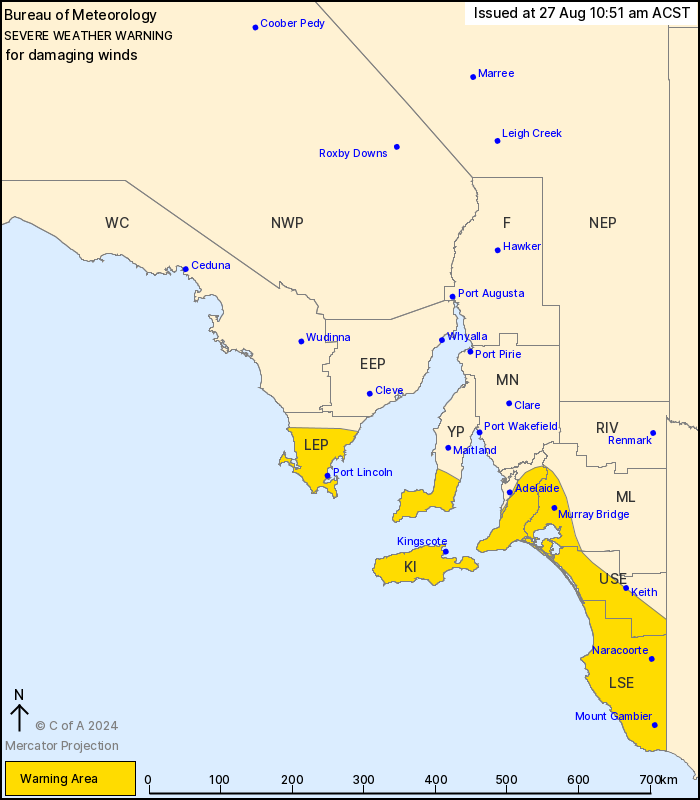
For people in Mount Lofty Ranges, Lower Eyre Peninsula, Kangaroo
Island, Upper South East, Lower South East and parts of Adelaide
Metropolitan, Yorke Peninsula and Murraylands districts.
Issued at 10:51 am Tuesday, 27 August 2024.
Damaging wind risk increasing today, contracting south
overnight.
Weather Situation: A strong cold front approaching the southwest
coast will cross Eyre and Yorke Peninsulas and the southeast in the
afternoon, and move into Victoria by Wednesday morning. Strong
northwesterly winds are expected ahead of the front, followed by
westerly winds behind it.
DAMAGING WINDS, averaging 60 to 70 km/h with peak gusts of about
90 km/h, are possible in southern parts of Eyre and Yorke
Peninsulas, Kangaroo Island and the Mount Lofty Ranges including
parts of the Adelaide Foothills today. The risk of damaging winds
will extend to parts of the southeast during the mid
afternoon.
Winds are expected to ease over Eyre and Yorke Peninsulas,
Kangaroo Island and the Mount Lofty Ranges, including parts of the
Adelaide Foothills, overnight tonight following the passage of the
cold front. However damaging winds remain possible in the southeast
especially during Wednesday afternoon.
Locations which may be affected include Port Lincoln, Mount
Gambier, Murray Bridge, Kingscote, Naracoorte and Meningie.
The State Emergency Service advises that people should:
* Move vehicles under cover or away from trees;
* Secure or put away loose items around your property.
* Stay indoors, away from windows, while conditions are
severe.
27/Aug/2024 01:36 AM

