
Source: Bureau of Meteorology
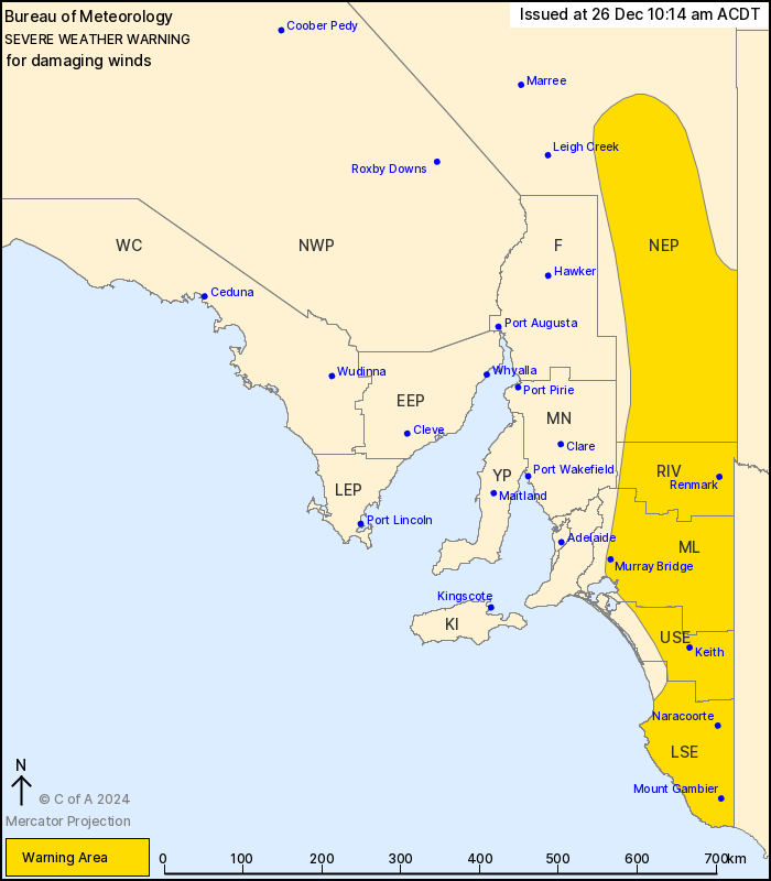
For people in Riverland, Murraylands, Upper South East, Lower
South East and parts of North East Pastoral districts.
Issued at 10:14 am Thursday, 26 December 2024.
Damaging wind gusts possible with the passage of a cold front this
afternoon and evening over eastern SA.
Weather Situation: A cold front crossing South Australia today
will reach central areas in the middle of the day, then eastern
areas during the afternoon and evening. Northwesterly winds will
strengthen and shift west to southwest on and immediately behind
the front before weakening by the late evening as the front moves
well into Victoria and NSW.
DAMAGING WINDS, averaging 60 to 70 km/h with peak gusts of around
90 km/h, are possible with and for the period following the cold
front from early this afternoon. Winds will ease below warning
thresholds over inland parts of the southeast in the late
afternoon, then ease in the northeast by the late evening.
However, the risk of DAMAGING WINDS will continue during the
evening and overnight about the coastal fringe of the Lower South
East, easing early Friday morning.
Locations which may be affected include Renmark, Mount Gambier,
Murray Bridge, Naracoorte, Lameroo and Bordertown.
The State Emergency Service advises that people should:
* Move vehicles under cover or away from trees;
* Secure or put away loose items around your property.
* Stay indoors, away from windows, while conditions are
severe.
25/Dec/2024 11:57 PM

