
Source: Bureau of Meteorology
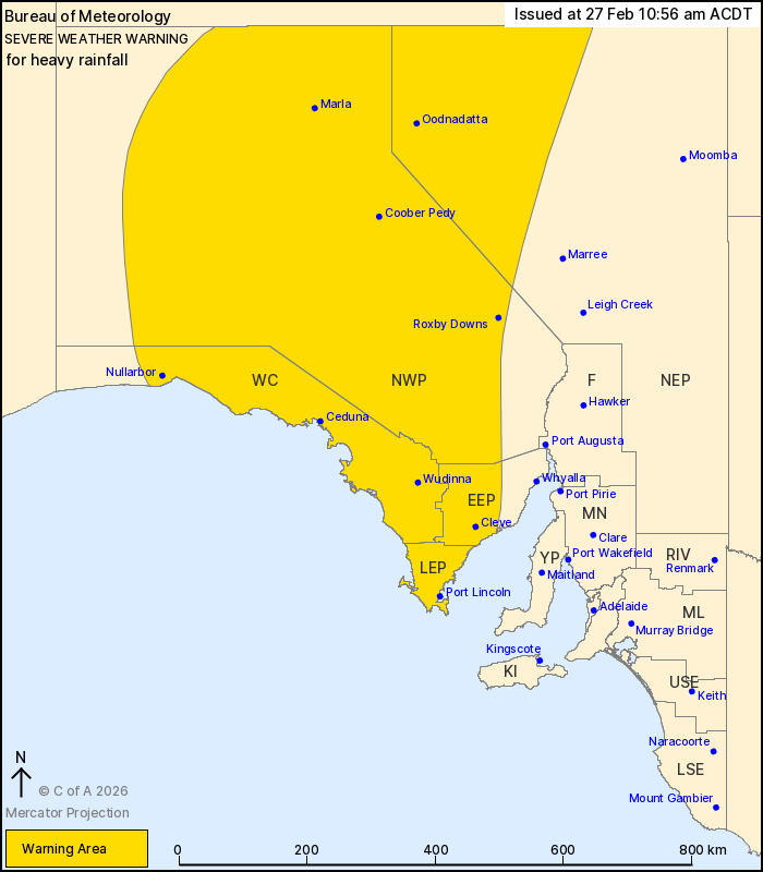
For people in West Coast, Lower Eyre Peninsula, Eastern Eyre
Peninsula, North West Pastoral and parts of North East Pastoral
districts.
Issued at 10:56 am Friday, 27 February 2026.
Heavy rainfall developing about northern and western parts of the
state this afternoon, spreading further southeast during the
weekend.
Weather Situation: A low pressure system located over southern
parts of the Northern Territory is expected to move to the west
today before shifting south over the weekend. An extremely humid
tropical airmass is wrapping around the southern flank of this low,
extending into central parts of the state during the next 24 hours.
A trough over southern SA is likely to interact with the tropical
airmass, with the prolonged rain event spreading to the southeast
over the weekend.
HEAVY RAINFALL which may lead to FLASH FLOODING is forecast for
parts of the north and west of the state during Friday, spreading
to the Eyre Peninsula and southeast parts of the North West
Pastoral from early Saturday morning. Six hour rainfall totals
between 30 and 70 mm are likely. 24 hour rainfall totals between 40
and 80 mm are likely, with isolated totals to 120 mm
possible.
Areas of heavy rainfall are likely to extend over the weekend and
shift across southeast parts of the state.
Flood Watches and Warnings are current for the area. Please refer
to https://www.bom.gov.au/weather-and-climate/warnings-and-alerts/
for more information.
Locations which may be affected include Port Lincoln, Ceduna,
Marla, Coober Pedy, Roxby Downs and Wudinna.
The State Emergency Service advises that people should:
* Don't drive, ride or walk through flood water;
* Keep clear of creeks and storm drains;
* Stay indoors, away from windows, while conditions are
severe.
27/Feb/2026 12:36 AM

