
Source: Bureau of Meteorology
Issued at 12:42 pm EST on Friday 30 August 2024
By the Bureau of Meteorology, Hobart.
Flood Watch Number: 6
FLOODING POSSIBLE THROUGHOUT THE FLOOD WATCH AREA FROM
FRIDAY
A cold front is expected to cross Tasmania during Friday. Further
cold fronts will cross the state on Saturday, Sunday and early
Monday mornings.
Catchments across Tasmania are relatively wet from rainfall over
the last several weeks, and catchments will react quickly to
rainfall.
Showers tending to rain are forecast for the next few days, with
total accumulated rainfall likely to be greater than 100mm in parts
of the Flood Watch area.
Widespread flooding is possible throughout the Flood Watch area
from Friday and into the weekend.
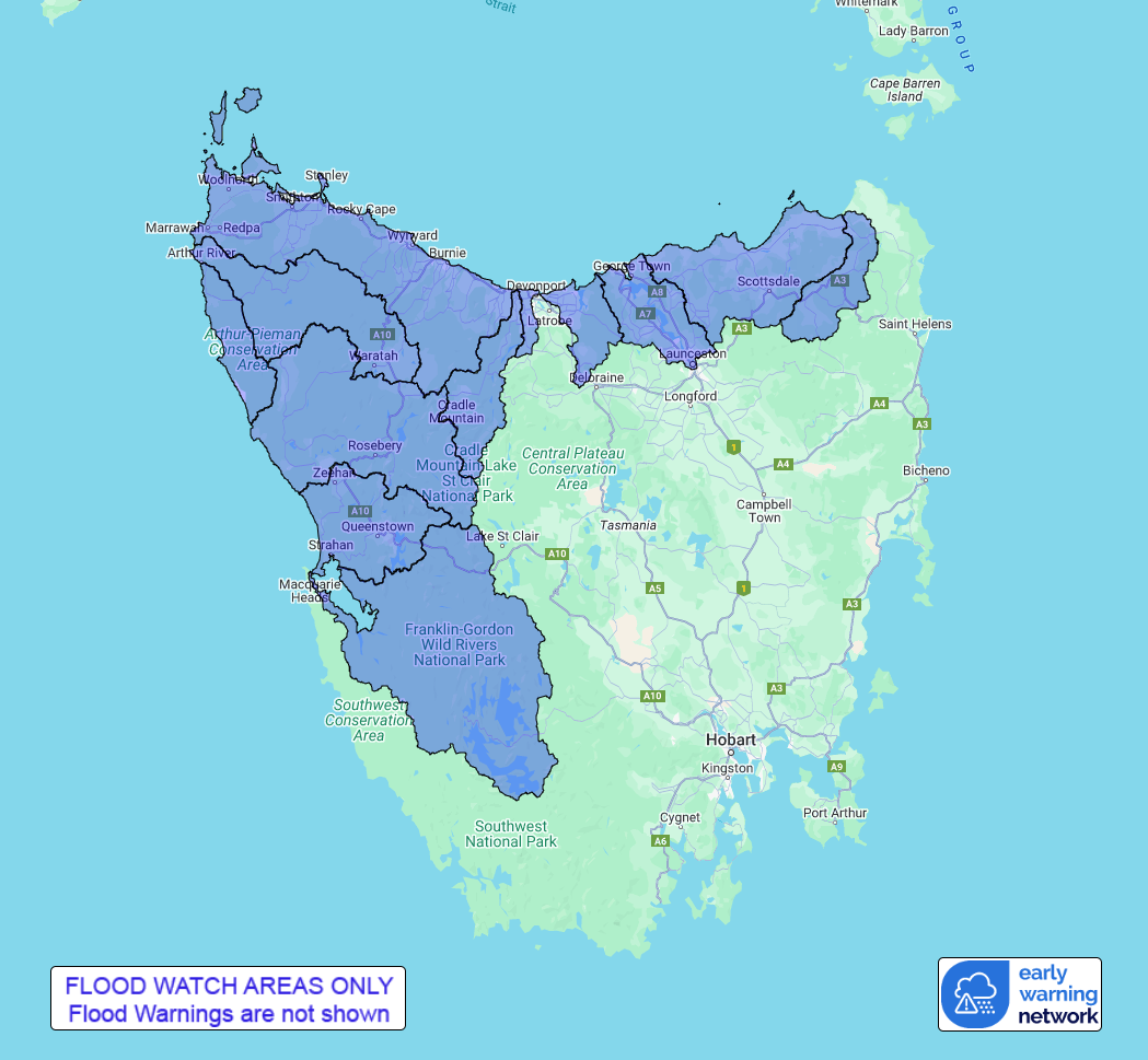
Catchments likely to be affected include:
Ringarooma River
North Coastal Rivers
Tamar (Launceston)
Forth River
Northwest and Central Coastal Rivers
Arthur River
Nelson Bay Coastal Rivers
Pieman River
King-Henty Rivers
Gordon-Franklin Rivers
Flood warnings are current for: North Esk River, South Esk River,
Macquarie River, River Derwent, River Ouse, Styx and Tyenna Rivers,
Huon River, Mersey River, and Meander River catchments.
Note: This Flood Watch is a "heads up" for possible future
flooding and is NOT a Flood Warning. The Bureau of Meteorology does
not provide a flood warning service for all of the catchments
covered by this flood watch. For more information on the Flood
Watch Service:
http://www.bom.gov.au/water/floods/floodWarningServices.shtml
For the latest warnings see www.bom.gov.au/tas/warnings
For the latest rainfall and river level information see
www.bom.gov.au/tas/flood
For the latest weather forecast see
www.bom.gov.au/tas/forecasts
Flood Safety Advice:
SES flood warnings can be found at TasALERT.com
Flood and storm safety advice is available at
www.ses.tas.gov.au
Road closure information is available at
www.police.tas.gov.au
For emergency assistance call the SES on telephone number 132
500.
For life threatening situations, call 000 immediately.
Rainfall and River
Conditions Map
30/Aug/2024 03:04 AM

