
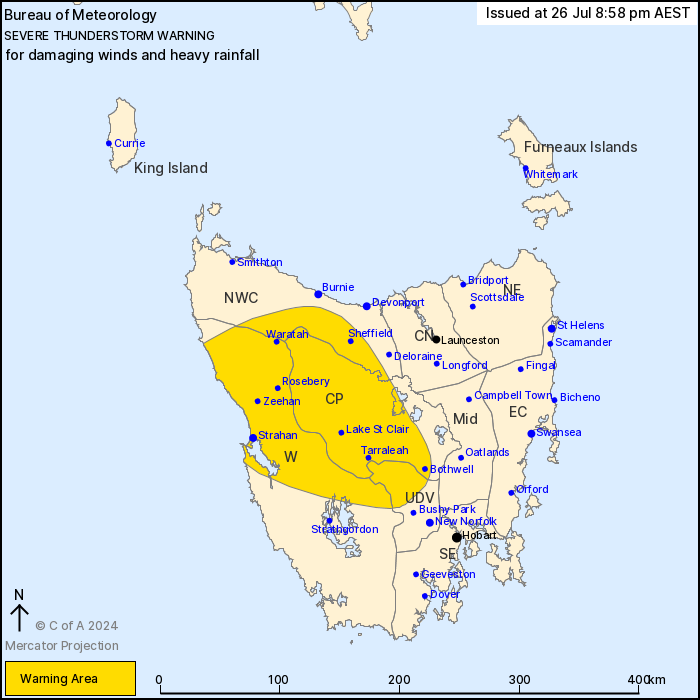
Source: Bureau of Meteorology
For people in Central Plateau and parts of Western, Upper Derwent
Valley and North West Coast Forecast Districts.
Issued at 8:58 pm Friday, 26 July 2024.
Severe thunderstorms have developed this evening.
Weather Situation: A strong cold front to the west of Tasmania is
directing a fresh northwesterly air stream over the state. Unstable
conditions have led to the development of showers and
thunderstorms, some are severe.
Severe thunderstorms are likely to produce damaging winds and
heavy rainfall that may lead to flash flooding in the warning area
over the next several hours. Locations which may be affected
include Sheffield, Strahan, Queenstown, Zeehan, Bothwell and
Tarraleah.
96 km/h wind gust was recorded at Burnie at 8:18pm.
37 mm of rainfall was recorded at Lake Plimsoll in the 2 hours to
7:45pm.
The State Emergency Service advises that people should:
* Move your car under cover or away from trees.
* Secure loose outdoor items.
* Avoid driving, walking or riding through flood waters.
* Seek shelter, preferably indoors and never under trees.
* Avoid using the telephone during a thunderstorm.
* Beware of fallen trees and powerlines.
* For emergency assistance contact the SES on 132500.
26/Jul/2024 11:06 AM

