
Source: Bureau of Meteorology
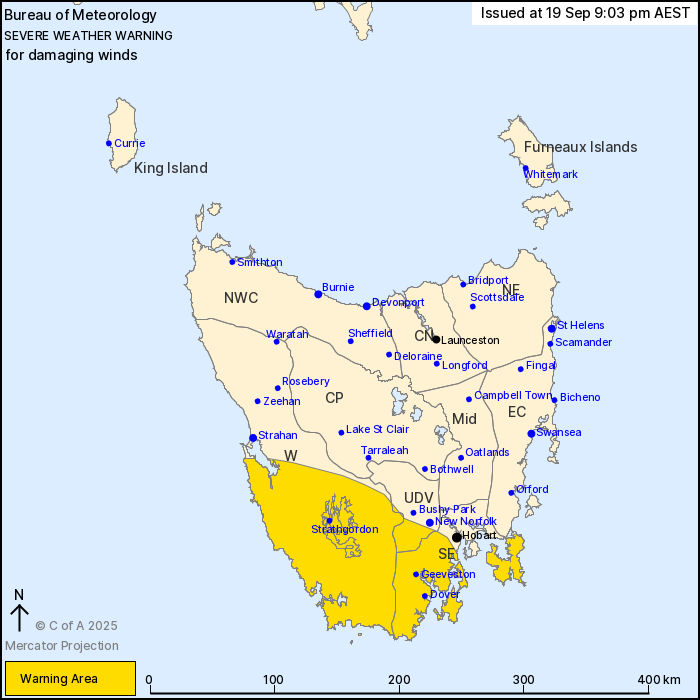
For people in South East and parts of Western and Upper Derwent
Valley Forecast Districts.
Issued at 9:03 pm Friday, 19 September 2025.
Damaging winds continue over the south of the state this evening
and into Saturday morning.
Weather Situation: A cold front is moving over the state this
evening and will reach the Tasman Sea by midnight. A vigorous
northwesterly wind regime persists over the south of the state in
its wake as a low pressure system slides past the south coast
overnight. Winds will tend west to southwesterly during early
Saturday morning and will begin to ease from the west as the low
moves into the Tasman Sea.
DAMAGING NORTHWESTERLY WINDS averaging 60 to 70 km/h with peak
gusts of around 100 km/h are possible this evening. Winds will
shift to the west the southwest early Saturday morning with the
DAMAGING WINDS likely to continue until mid-morning.
Locations which may be affected include Geeveston, Dover,
Strathgordon and Huonville.
Severe weather is no longer occurring in the Central Plateau
district and the warning for this district is CANCELLED.
The State Emergency Service advises that people should:
* Supervise children closely.
* Check that family and neighbours are aware of warnings.
* Manage pets and livestock.
* Secure outdoor items including furniture and play
equipment.
* Be prepared in case of power outages and report any outages to
TasNetworks on 132 004.
* Beware of damaged trees and power lines and take care when
driving.
* Listen to the ABC radio or check www.ses.tas.gov.au for further
advice.
* For emergency assistance contact the SES on 132500.
19/Sep/2025 11:09 AM


