
Source: Bureau of Meteorology
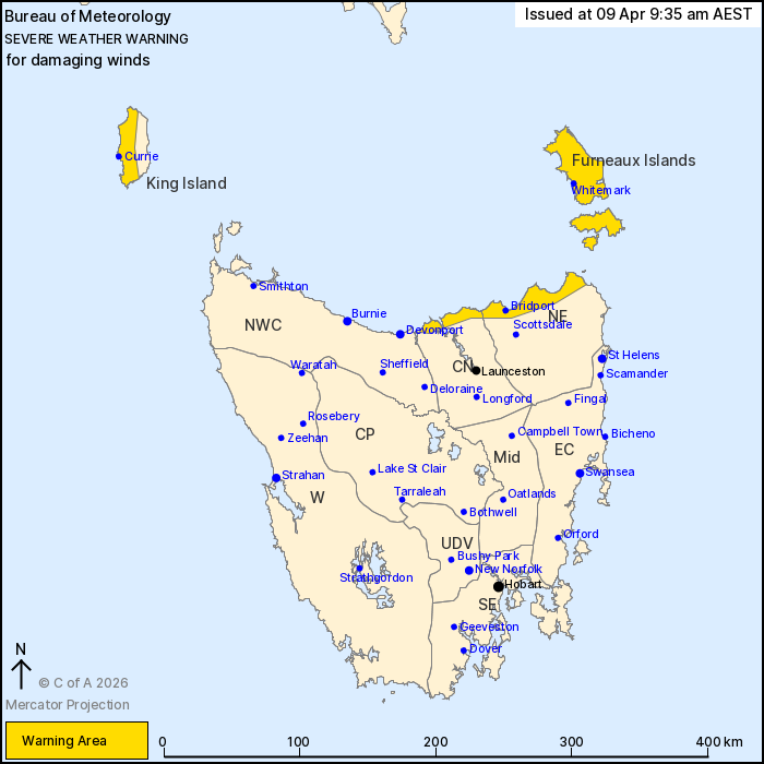
For people in Furneaux Islands and parts of King Island, North
East and Central North Forecast Districts.
Issued at 9:35 am Thursday, 9 April 2026.
Damaging winds about northern Tasmania on Friday.
Weather Situation: A cold front is expected to cross the state
later today bringing cool and gusty conditions. However, a more
vigorous westerly change is expected during the day on Friday,
bringing damaging winds about northern Tasmania, especially with
shower and thunderstorm activity.
DAMAGING WINDS averaging 55 to 65 km/h with peak gusts around 100
km/h are likely to develop about King Island during Friday morning,
extending to parts of northeastern Tasmania including the Furneaux
Islands during the afternoon.
Winds are expected to gradually ease below warning thresholds
during Friday evening.
Locations which may be affected include Currie, Whitemark,
Bridport, George Town and Low Head.
The State Emergency Service advises that people should:
* Supervise children closely.
* Check that family and neighbours are aware of warnings.
* Manage pets and livestock.
* Secure outdoor items including furniture and play
equipment.
* Be prepared in case of power outages and report any outages to
TasNetworks on 132 004.
* Beware of damaged trees and power lines and take care when
driving.
* Listen to the ABC radio or check www.ses.tas.gov.au for further
advice.
* For emergency assistance contact the SES on 132500.
08/Apr/2026 11:42 PM

