Source: Bureau of Meteorology
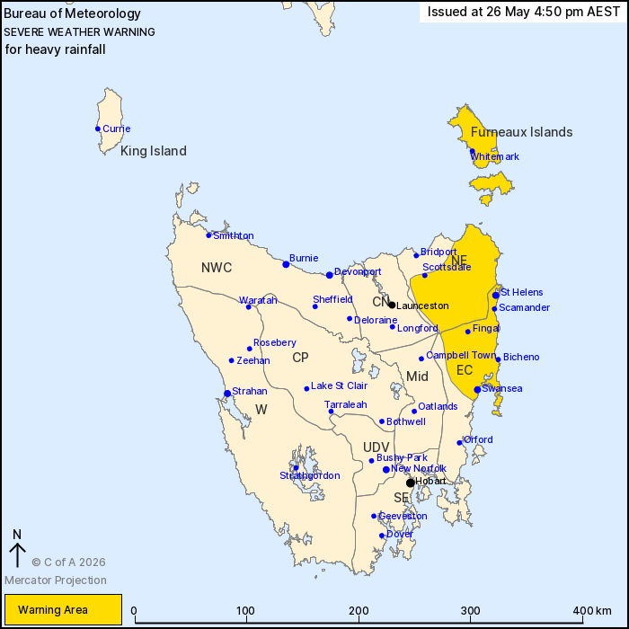
For people in Furneaux Islands, North East and parts of East Coast
Forecast Districts.
Issued at 4:50 pm Tuesday, 26 May 2026.
Heavy rainfall possible over northeastern areas from early
Wednesday.
Weather Situation: An upper trough will develop a low pressure
system in the Tasman Sea from late Tuesday night. This low is
likely to move through Bass Strait on Wednesday morning, bringing
elevated moisture to northeastern Tasmania and a risk of heavy
rainfall.
HEAVY RAINFALL which may lead to FLASH FLOODING is forecast for
northeastern and eastern parts of the state from early Wednesday
morning. Six-hourly rainfall totals between 30 to 50 mm are
possible, with localised falls up to 80 mm possible over elevated
areas. 24-hourly rainfall totals between 60 to 100 mm are possible,
with localised falls up to 150 mm.
Heavy rainfall is likely to ease below warning thresholds later on
Wednesday evening.
Locations which may be affected include St Helens, Swansea,
Scottsdale, Whitemark, Bicheno, Fingal and Scamander.
The State Emergency Service advises that people should:
* Supervise children closely.
* Check that family and neighbours are aware of warnings.
* Manage pets and livestock.
* Clear drains and gutters on premises prior to severe weather
arriving.
* Do not walk, ride or drive through flood waters.
* Be prepared in case of power outages and report any outages to
TasNetworks on 132 004.
* Listen to the ABC radio or check www.ses.tas.gov.au for further
advice.
* For emergency assistance contact the SES on 132500.
26/May/2026 06:57 AM