
Source: Bureau of Meteorology
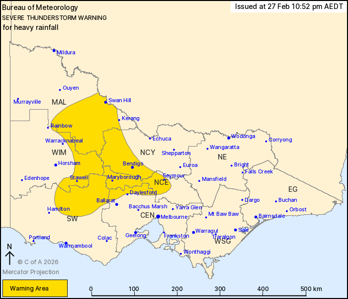
For people in parts of Central, Mallee, South West, Northern
Country, North Central and Wimmera Forecast Districts.
Issued at 10:52 pm Friday, 27 February 2026.
Severe thunderstorms with heavy rainfall continue over central and
western parts of Victoria this evening.
Weather Situation: Slow-moving thunderstorms are continuing in a
very humid environment, bringing heavy rainfall to parts of central
and western Victoria this evening.
Severe thunderstorms are likely to produce heavy rainfall that may
lead to flash flooding in the warning area over the next several
hours. Locations which may be affected include Bendigo, Seymour,
Maryborough, Swan Hill, Stawell and Castlemaine.
Severe thunderstorms are no longer occurring in the North East
district and the warning for this district is CANCELLED.
34.2 MM WAS RECORDED AT KELLALAC (WARRACKNABEAL AIRPORT) IN THE 30
MINUTES TO 8:36 PM.
35.8 MM WAS RECORDED AT BROADFORD IN THE 30 MINUTES TO 7:48
PM.
42.4 MM WAS RECORDED AT HORSHAM IN THE 30 MINUTES TO 7:30
PM.
28.2 mm was recorded at Marnoo East in the 60 minutes to 10:00
pm.
27.4 mm was recorded at Edenhope Airport in the 30 minutes to 8:18
pm.
27.4 mm was recorded at Longerenong in the 60 minutes to 8:12
pm.
The State Emergency Service advises that people should:
* If driving conditions are dangerous, safely pull over away from
trees, drains, low-lying areas and floodwater. Avoid travel if
possible.
* Stay safe by avoiding dangerous hazards, such as floodwater,
mud, debris, damaged roads and fallen trees.
* Be aware - heat, fire or recent storms may make trees unstable
and more likely to fall when it's windy or wet.
* Check that loose items, such as outdoor settings, umbrellas and
trampolines are safely secured. Move vehicles under cover or away
from trees.
* Stay indoors and away from windows.
* If outdoors, move to a safe place indoors. Stay away from trees,
drains, gutters, creeks and waterways.
* Stay away from fallen powerlines - always assume they are
live.
* Be aware that in fire affected areas, rainfall run-off into
waterways may contain debris such as ash, soil, trees and rocks.
Heavy rainfall may also increase the potential for landslides and
debris across roads.
* Stay informed: Monitor weather warnings, forecasts and river
levels at the Bureau of Meteorology website, and warnings through
VicEmergency website/app/hotline.
27/Feb/2026 12:37 PM

