
Source: Bureau of Meteorology
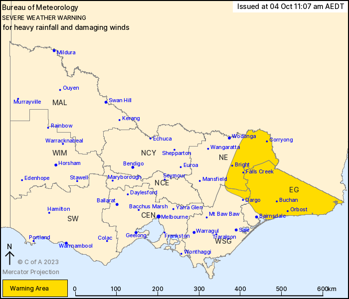
For people in East Gippsland and parts of North East and West and
South Gippsland Forecast Districts.
Issued at 11:07 am Wednesday, 4 October 2023.
Heavy rainfall and damaging winds persisting in the east until
Wednesday afternoon, before redeveloping during Thursday
morning.
Weather situation: Strong northwesterly winds and isolated heavy
rainfall persists across elevated parts of northeast Victoria this
morning ahead of a cold front and associated upper trough.
Conditions should ease for a period from this afternoon as a low
pressure system develops over southern New South Wales. This low
will move over waters to the east of Victoria during Thursday
morning, with a strong southwesterly flow developing in its wake.
This should bring another period of damaging winds and heavy
rainfall to the far east of the State during Thursday.
For WEDNESDAY: DAMAGING NORTH TO NORTHWESTERLY WINDS averaging 60
to 70 km/h with peak gusts of 90 to 100 km/h are possible over the
Alpine peaks ABOVE 1500 m until late Wednesday afternoon. HEAVY
RAINFALL which may lead to FLASH FLOODING is possible over the
northeast ranges until late Wednesday afternoon. Six-hourly
rainfall totals between 50 and 70 mm are possible.
For THURSDAY: DAMAGING SOUTHWESTERLY WINDS averaging 60 to 70 km/h
with peak gusts in excess of 90 km/h are likely over parts of East
Gippsland and the eastern ranges from early Thursday morning,
easing by early Thursday afternoon. HEAVY RAINFALL which may lead
to FLASH FLOODING is also possible over the eastern ranges during
Thursday morning, with six-hourly totals of 60 to 80 mm
possible.
Flood watches and warnings are current for eastern catchments.
Please refer to http://www.bom.gov.au/vic/warnings/
Locations which may be affected include Corryong, Bright, Orbost,
Falls Creek, Mt Hotham and Omeo.
Severe weather is no longer occurring in the Central, Northern
Country and North Central districts and the warning for these
districts is CANCELLED.
Significant wind observations to 11:00 AM AEDT Wednesday
include:
139 km/h recorded at Mount Buller
131 km/h recorded at Mount Hotham
113 km/h recorded at Falls Creek
93 km/h recorded at Mount Nowa Nowa
93 km/h recorded at Mount Moornapa
Significant rainfall in the 24 hours to 9am Wednesday:
Mount Hotham 198.8 mm
Falls Creek 149.4 mm
Harrietville 123.8 mm
Lake Eildon 108 mm
Mansfield 105.4 mm
Briagolong 101.6 mm
Sale 99.2 mm
The State Emergency Service advises that people should:
* If driving conditions are dangerous, safely pull over away from
trees, drains, low-lying areas and floodwater. Avoid travel if
possible.
* Stay safe by avoiding dangerous hazards, such as floodwater,
mud, debris, damaged roads and fallen trees.
* Be aware - heat, fire or recent storms may make trees unstable
and more likely to fall when it's windy or wet.
* Check that loose items, such as outdoor settings, umbrellas and
trampolines are safely secured. Move vehicles under cover or away
from trees.
* Stay indoors and away from windows.
* If outdoors, move to a safe place indoors. Stay away from trees,
drains, gutters, creeks and waterways.
* Stay away from fallen powerlines - always assume they are
live.
* Be aware that in fire affected areas, rainfall run-off into
waterways may contain debris such as ash, soil, trees and rocks.
Heavy rainfall may also increase the potential for landslides and
debris across roads.
* Stay informed: Monitor weather warnings, forecasts and river
levels at the Bureau of Meteorology website, and warnings through
VicEmergency website/app/hotline.
04/Oct/2023 12:15 AM

