Source: Bureau of Meteorology
Issued at 11:58 am AWST on Saturday 14 March 2026
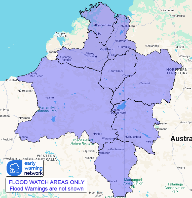
Flood Watch Number: 4
FLOODING POSSIBLE ACROSS THE FLOOD WATCH AREA FROM LATE
SATURDAY
A tropical low over the Kimberley District is slowly moving
towards the south
west during Saturday and Sunday. A trough is forecast to deepen
over south west
Northern Territory during Sunday and Monday. Fed by humid tropical
winds, these
systems are expected to generate widespread rainfall, across the
north and east
Kimberley and Fitzroy catchments from Saturday, extending to parts
of the
eastern Interior during the weekend.
Catchments in the Flood Watch area are already wet and are likely
to respond
quickly to additional rainfall.
Forecast rainfall may cause river and creek level rises, prolonged
overland
flooding, and ponding from Saturday onwards. Road access may be
affected, and
some communities and homesteads may become isolated.
Catchments likely to be affected include:
Fitzroy River
North Kimberley Rivers
East Kimberley Rivers
Warburton District Rivers
Sandy Desert (Eastern parts)
Sturt Creek District
Western Desert
Tanami Desert
For the latest flood and weather warnings see
www.bom.gov.au/weather-and-climate/warnings-and-alerts
For the latest rainfall and river level information see
www.bom.gov.au/australia/flood
Safety Advice:
* Don't drive, walk, swim or play in floodwater because it is
dangerous.
* Stay away from flooded drains, rivers, streams and
waterways.
* Obey road closure signs. Plan ahead so you don't drive on
flooded roads.
* Check the ABC and local media for updates. The situation can
change quickly,
so stay informed.
* For local emergency management warnings and advice visit
www.emergency.wa.gov.au/.
For emergency assistance call SES on telephone number 132 500.
In
life-threatening emergencies, call 000 (triple zero)
immediately.
Rainfall and River
Conditions Map